tour de la font sancte 2e jour
tchoua
User
Length
27 km
Max alt
2877 m
Uphill gradient
1774 m
Km-Effort
53 km
Min alt
1644 m
Downhill gradient
2408 m
Boucle
No
Creation date :
2022-06-26 05:35:25.11
Updated on :
2022-06-27 14:51:32.956
8h24
Difficulty : Difficult
FREE GPS app for hiking
About
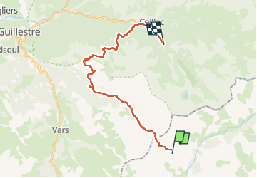
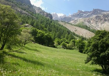
Trail Walking of 27 km to be discovered at Provence-Alpes-Côte d'Azur, Alpes-de-Haute-Provence, Saint-Paul-sur-Ubaye. This trail is proposed by tchoua.
Description
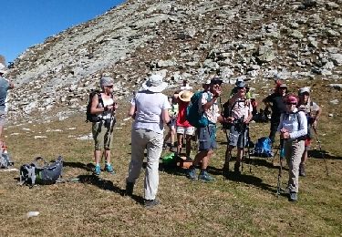
Cabane des houerts,basse rua,pic d escreins,cabane andrevez,ceillac
Joli petit tour en boucle ceillac ceillac
Positioning
Country:
France
Region :
Provence-Alpes-Côte d'Azur
Department/Province :
Alpes-de-Haute-Provence
Municipality :
Saint-Paul-sur-Ubaye
Location:
Unknown
Start:(Dec)
Start:(UTM)
325183 ; 4938376 (32T) N.
Comments
Trails nearby
05 Tour Font Sancte - étape 3
Walking
Very difficult
(1)
Saint-Paul-sur-Ubaye,
Provence-Alpes-Côte d'Azur,
Alpes-de-Haute-Provence,
France
16.7 km | 31 km-effort
7h 8min
No
Pic Panestrel
Walking
Difficult
(1)
Saint-Paul-sur-Ubaye,
Provence-Alpes-Côte d'Azur,
Alpes-de-Haute-Provence,
France
13 km | 32 km-effort
6h 16min
Yes
PLAN DE PAROUART DEPUIS MALJASSET
Walking
Difficult
Saint-Paul-sur-Ubaye,
Provence-Alpes-Côte d'Azur,
Alpes-de-Haute-Provence,
France
12.1 km | 15.6 km-effort
3h 20min
Yes
les portes de chillol
Touring skiing
Medium
Saint-Paul-sur-Ubaye,
Provence-Alpes-Côte d'Azur,
Alpes-de-Haute-Provence,
France
16.9 km | 31 km-effort
3h 45min
Yes
Col Mary et col marie Marinet
Walking
Very difficult
Saint-Paul-sur-Ubaye,
Provence-Alpes-Côte d'Azur,
Alpes-de-Haute-Provence,
France
18.3 km | 31 km-effort
5h 37min
No
vers le col du sanglier
Walking
Medium
Saint-Paul-sur-Ubaye,
Provence-Alpes-Côte d'Azur,
Alpes-de-Haute-Provence,
France
6.2 km | 14.9 km-effort
4h 55min
Yes
Aiguille Large
Walking
Medium
Saint-Paul-sur-Ubaye,
Provence-Alpes-Côte d'Azur,
Alpes-de-Haute-Provence,
France
17.5 km | 31 km-effort
6h 17min
Yes
Le Vallon de Mary
Snowshoes
Medium
Saint-Paul-sur-Ubaye,
Provence-Alpes-Côte d'Azur,
Alpes-de-Haute-Provence,
France
7.4 km | 12.4 km-effort
4h 43min
No
Tour du Plan de Parouart
Walking
Easy
(2)
Saint-Paul-sur-Ubaye,
Provence-Alpes-Côte d'Azur,
Alpes-de-Haute-Provence,
France
8.7 km | 12.1 km-effort
2h 45min
Yes