


2022-06-28 Marche TGV Refuge Valette Pralognan

holtzv
User GUIDE

Length
8.4 km

Max alt
2596 m

Uphill gradient
333 m
Km-Effort
16 km

Min alt
1639 m

Downhill gradient
1280 m
Boucle
No
Creation date :
2022-06-28 04:49:59.153
Updated on :
2022-06-29 17:19:50.893
4h20
Difficulty : Easy

FREE GPS app for hiking
 SityTrail
IGN / Geographical institutes
SityTrail Plus
The world is yours!
About
Trail Walking of 8.4 km to be discovered at Auvergne-Rhône-Alpes, Savoy, Pralognan-la-Vanoise. This trail is proposed by holtzv.
Description
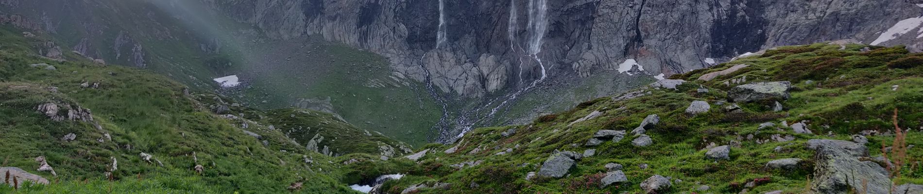
- Etape 05 - Refuge de la Valette - Pralognan Les Fontanettes
Photos


Positioning
Country:
France
Region :
Auvergne-Rhône-Alpes
Department/Province :
Savoy
Municipality :
Pralognan-la-Vanoise
Location:
Unknown
Start:(Dec)
Start:(UTM)
321729 ; 5024738 (32T) N.
Comments