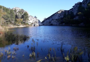
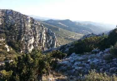
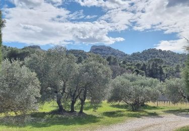
Trail Mountain bike Maussane-les-Alpilles - Les Baux de Provence - Photo
© OpenStreetMap contributors
Length
Length
21 km
Max alt
Max alt
292 m
Uphill gradient
Uphill gradient
492 m
Km-Effort
Km-Effort  
28 km
Min alt
Min alt
32 m
Downhill gradient
Downhill gradient
495 m
Boucle
Boucle
Yes
Creation date :
2014-12-10 00:00:00.0
Updated on :
2014-12-10 00:00:00.0

(0 Reviews)

Mountain bike
Mountain bike
2h00
Difficulty : Difficult

Scan this QR Code to open this trail in the SityTrail application

FREE GPS app for hiking

Logo SityTrail SityTrail

IGN / Geographical institutes

Download SityTrail from the App Store Download SityTrail from Google Play

Logo SityTrail SityTrail World

The world is yours!

Download SityTrail from the App Store Download SityTrail from Google Play Download SityTrail on Huawei AppGallery

About

Trail Mountain bike of 21 km to be discovered at Provence-Alpes-Côte d'Azur, Bouches-du-Rhône, Maussane-les-Alpilles. This trail is proposed by Vin100@33.

Description

Cet itinéraire physique traverse une région splendide parsemée de nombreux sites caractéristiques (Val d’Enfer, cité médiévale des Baux, etc.). Prévoir un cadenas en cas de visite des fortifications des Baux. Retrouvez plus de précisions sur le site de VTOPO.com

Elevation profile

Photos

Points of interest

Point of interest Maussane-les-Alpilles - Les Baux de Provence - Photo
Vin100@33
MAUSSANE-LES-ALPILLES 

Positioning

Country:
France
Region :
Provence-Alpes-Côte d'Azur
Department/Province :
Bouches-du-Rhône
Municipality :
Maussane-les-Alpilles
Location:
Unknown
Start:(UTM)
645619 ; 4842864 (31T) N.

Trails nearby

Trail Walking Saint-Rémy-de-Provence - Alpilles  - Photo
Walking
GUIDE
nadinebondoux

Walking

Difficult
(1)
Saint-Rémy-de-Provence, Provence-Alpes-Côte d'Azur, Bouches-du-Rhône, France
19.2 km | 27 km-effort
5h 7min
No
Trail Walking Saint-Rémy-de-Provence - Les Alpilles pas de l aigle - Photo
Walking
pierrot30

Walking

Medium
(2)
Saint-Rémy-de-Provence, Provence-Alpes-Côte d'Azur, Bouches-du-Rhône, France
10.3 km | 14 km-effort
3h 44min
Yes
Trail Walking Saint-Rémy-de-Provence - PF-Saint-Rémy-de-Provence - La Piste des Lombards - Photo
Walking
MicDul

Walking

Easy
(1)
Saint-Rémy-de-Provence, Provence-Alpes-Côte d'Azur, Bouches-du-Rhône, France
7.6 km | 10.1 km-effort
2h 15min
Yes
Trail Walking Les Baux-de-Provence - Maussane - Vallon des amants - les grands Calans - Photo
Walking
Nathy8913

Walking

Medium
(2)
Les Baux-de-Provence, Provence-Alpes-Côte d'Azur, Bouches-du-Rhône, France
16.1 km | 22 km-effort
5h 5min
Yes
Trail Walking Maussane-les-Alpilles - Tour des Trincades - Photo
Walking
Amaralain

Walking

Medium
(1)
Maussane-les-Alpilles, Provence-Alpes-Côte d'Azur, Bouches-du-Rhône, France
9.5 km | 13.5 km-effort
2h 55min
Yes
Trail Walking Les Baux-de-Provence - alpilles , les baux -st etienne du grès - Photo
Walking
ritchi

Walking

Medium
(1)
Les Baux-de-Provence, Provence-Alpes-Côte d'Azur, Bouches-du-Rhône, France
12.6 km | 16 km-effort
3h 32min
Yes
Trail Walking Maussane-les-Alpilles - Maussane Les Baux Maussane - Photo
Walking
hervef13300

Walking

Medium
(2)
Maussane-les-Alpilles, Provence-Alpes-Côte d'Azur, Bouches-du-Rhône, France
15 km | 19.2 km-effort
4h 12min
No
Trail sport Saint-Rémy-de-Provence - 2024-02-04_13h04m18_COURSE_246375352 - Photo
sport
DL72

sport

Very easy
(1)
Saint-Rémy-de-Provence, Provence-Alpes-Côte d'Azur, Bouches-du-Rhône, France
16.6 km | 21 km-effort
Unknown
Yes
Trail Walking Saint-Rémy-de-Provence - SityTrail - ST REMY / LAC PEIROOU -  LA CAUME - 1er AVRIL 2023 - Photo
Walking
MicDul

Walking

Difficult
Saint-Rémy-de-Provence, Provence-Alpes-Côte d'Azur, Bouches-du-Rhône, France
9 km | 12.6 km-effort
2h 52min
Yes


Close
My subscriptions