Trail Walking Val-Cenis - Mont Giusalet - Photo
 yves12
yves12

User

© OpenStreetMap contributors
Length
Length
14.4 km
Max alt
Max alt
3303 m
Uphill gradient
Uphill gradient
1567 m
Km-Effort
Km-Effort  
35 km
Min alt
Min alt
1816 m
Downhill gradient
Downhill gradient
1581 m
Boucle
Boucle
Yes
Creation date :
2022-06-29 06:40:25.0
Updated on :
2022-06-30 07:46:55.49

(0 Reviews)

Walking
Walking
10h47
Difficulty : Very difficult

Scan this QR Code to open this trail in the SityTrail application

FREE GPS app for hiking

Logo SityTrail SityTrail

IGN / Geographical institutes

Download SityTrail from the App Store Download SityTrail from Google Play

Logo SityTrail SityTrail World

The world is yours!

Download SityTrail from the App Store Download SityTrail from Google Play Download SityTrail on Huawei AppGallery

About

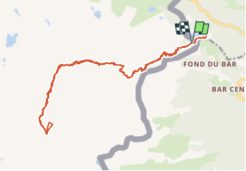
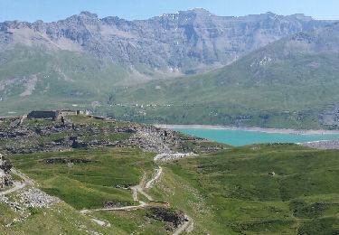
Trail Walking of 14.4 km to be discovered at Auvergne-Rhône-Alpes, Savoy, Val-Cenis. This trail is proposed by yves12.

Description

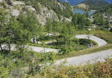
Départ du parking de " Giorgio a d'Arpon "en Italie.
Pour y parvenir prendre la route du Mont Cenis D 1006 pour arriver en Italie . Continuer en direction de Bar Cenisio puis peu de temps avant d'y arriver prendre la petite route de montagne étroite et non goudronné située sur la droite pour arriver au parking de Giogio d'Arpon".
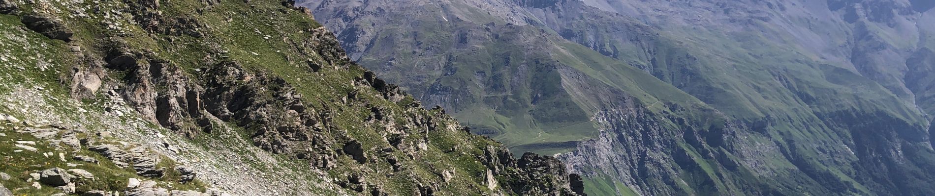
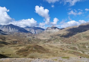
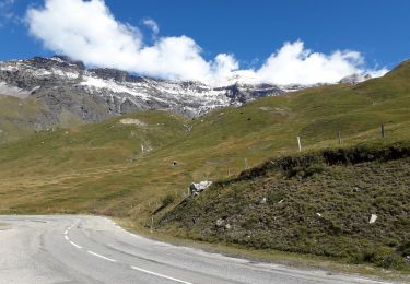
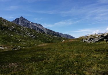
Ensuite le sentier pour monter au Giusalet est bien marqué en rouge et blanc et avec des cairns. A savoir que là haut il y a  un passage avec des gros pierriés sur lesquels il faut mettre les mains pour progresser, ce n'est pas que du sentier mais très bien marqué tout de même.

Elevation profile

Photos

39 photos in total. Please click on a photo to see them all in the gallery.

Positioning

Country:
France
Region :
Auvergne-Rhône-Alpes
Department/Province :
Savoy
Municipality :
Val-Cenis
Location:
Lanslebourg-Mont-Cenis
Start:(UTM)
340254 ; 5006785 (32T) N.

Trails nearby

Trail Walking Val-Cenis - Savoie_Barrage-du-Mont-Cenis=>Fort-de-Variselle - Photo
Walking
BMorin91470

Walking

Easy
Val-Cenis, Auvergne-Rhône-Alpes, Savoy, France
5.7 km | 7.6 km-effort
2h 44min
Yes
Trail On foot Val-Cenis - IT-581 - Photo
On foot
PRO

On foot

Easy
Val-Cenis, Auvergne-Rhône-Alpes, Savoy, France
6.4 km | 9.4 km-effort
2h 7min
No
Trail Walking Val-Cenis - LAC DU MONT-CENIS (73) - Photo
Walking
AndreLACOMBE

Walking

Easy
Val-Cenis, Auvergne-Rhône-Alpes, Savoy, France
13.2 km | 19.7 km-effort
5h 50min
Yes
Trail Walking Val-Cenis - montée au firt de Pattacreuse. - Photo
Walking
tyax93

Walking

Easy
Val-Cenis, Auvergne-Rhône-Alpes, Savoy, France
5.2 km | 9 km-effort
1h 29min
No
Trail Walking Val-Cenis - 1 9 20 - Photo
Walking
micheleuvrard

Walking

Very easy
Val-Cenis, Auvergne-Rhône-Alpes, Savoy, France
6 km | 8.6 km-effort
2h 10min
Yes
Trail Horseback riding Val-Cenis - Mont Cenis lac Savine - Photo
Horseback riding
xhakon

Horseback riding

Medium
Val-Cenis, Auvergne-Rhône-Alpes, Savoy, France
36 km | 49 km-effort
7h 8min
Yes
Trail Walking Val-Cenis - Boucle au pied du Mont Cenis - 12 juillet 2015 - Photo
Walking
morganee

Walking

Difficult
Val-Cenis, Auvergne-Rhône-Alpes, Savoy, France
25 km | 39 km-effort
8h 1min
Yes
Trail On foot Venaus - IT-582A - Photo
On foot
PRO

On foot

Easy
Venaus, Piemont, Torino, Italy
3.7 km | 9.5 km-effort
2h 9min
No
Trail On foot Venaus - 582 - Photo
On foot
PRO

On foot

Easy
Venaus, Piemont, Torino, Italy
4.6 km | 10.2 km-effort
2h 18min
No


Close
My subscriptions