


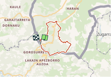
Rando les Palombières de Sare

Fab-Oz
User

Length
11.9 km

Max alt
520 m

Uphill gradient
572 m
Km-Effort
19.5 km

Min alt
113 m

Downhill gradient
569 m
Boucle
Yes
Creation date :
2022-07-05 07:40:36.953
Updated on :
2022-07-05 10:48:56.72
2h58
Difficulty : Medium

FREE GPS app for hiking
 SityTrail
IGN / Geographical institutes
SityTrail Plus
The world is yours!
About
Trail Walking of 11.9 km to be discovered at New Aquitaine, Pyrénées-Atlantiques, Sare. This trail is proposed by Fab-Oz.
Description
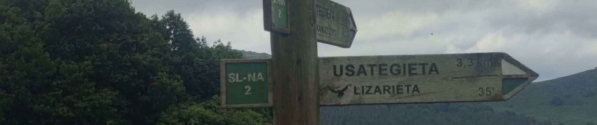
Au départ du col de Lizarrieta, boucle de 12km, retour les Palombières et les crêtes
Photos

Positioning
Country:
France
Region :
New Aquitaine
Department/Province :
Pyrénées-Atlantiques
Municipality :
Sare
Location:
Unknown
Start:(Dec)
Start:(UTM)
612069 ; 4790724 (30T) N.
Comments