Trail Walking Loubressac - Camping La Garrigue  - Photo

Camping La Garrigue

 Gegetop
Gegetop

User

© OpenStreetMap contributors
Length
Length
14.1 km
Max alt
Max alt
386 m
Uphill gradient
Uphill gradient
253 m
Km-Effort
Km-Effort  
17.5 km
Min alt
Min alt
313 m
Downhill gradient
Downhill gradient
253 m
Boucle
Boucle
Yes
Creation date :
2022-07-05 09:11:04.227
Updated on :
2022-07-06 06:36:28.239

(0 Reviews)

Walking
Walking
3h50
Difficulty : Medium
Nordic walking
Nordic walking
3h21
Difficulty : Medium

Scan this QR Code to open this trail in the SityTrail application

FREE GPS app for hiking

Logo SityTrail SityTrail

IGN / Geographical institutes

Download SityTrail from the App Store Download SityTrail from Google Play

Logo SityTrail SityTrail World

The world is yours!

Download SityTrail from the App Store Download SityTrail from Google Play Download SityTrail on Huawei AppGallery

About

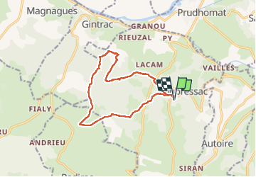
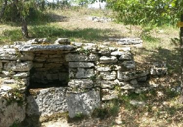
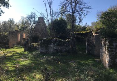
Trail Walking of 14.1 km to be discovered at Occitania, Lot, Loubressac. This trail is proposed by Gegetop.

Description

Départ du camping et boucle dans les calades et murets de pierres sèches à travers bois et pâturages.

Elevation profile

Photos

Positioning

Country:
France
Region :
Occitania
Department/Province :
Lot
Municipality :
Loubressac
Location:
Unknown
Start:(UTM)
405206 ; 4969061 (31T) N.

Trails nearby

Trail Walking Loubressac - Nos plus beaux villages - Photo
Walking
alain2306

Walking

Difficult
(1)
Loubressac, Occitania, Lot, France
9.9 km | 14.2 km-effort
3h 0min
Yes
Trail Walking Prudhomat - autour de castelnau - Photo
Walking
lefrancm

Walking

Very easy
(1)
Prudhomat, Occitania, Lot, France
3.5 km | 4.8 km-effort
1h 48min
No
Trail Walking Loubressac - Loubressac-Château des Anglais - Photo
Walking
werth

Walking

Easy
Loubressac, Occitania, Lot, France
8.6 km | 12.1 km-effort
2h 21min
Yes
Trail On foot Saint-Jean-Lespinasse - St Jean Lespinasse - La Césarine - Photo
On foot
PRO

On foot

Easy
Saint-Jean-Lespinasse, Occitania, Lot, France
3.8 km | 5.9 km-effort
1h 20min
Yes
Trail Walking Carennac - Magnagues - Photo
Walking
Gaillard Isabelle

Walking

Very easy
Carennac, Occitania, Lot, France
16.8 km | 21 km-effort
4h 51min
Yes
Trail Walking Loubressac - autoire cascade siran - Photo
Walking
Forsans

Walking

Medium
Loubressac, Occitania, Lot, France
5.5 km | 8.4 km-effort
1h 55min
No
Trail Walking Carennac - Ruines de Taillefer - Photo
Walking
neleda

Walking

Very easy
Carennac, Occitania, Lot, France
6.4 km | 8.2 km-effort
1h 54min
No
Trail Walking Loubressac - Laguizayrie - Photo
Walking
Gaillard Isabelle

Walking

Easy
Loubressac, Occitania, Lot, France
15.9 km | 20 km-effort
3h 59min
Yes
Trail Walking Autoire - Autoire - Loubressac - Photo
Walking
neitag61

Walking

Medium
Autoire, Occitania, Lot, France
10.4 km | 15.1 km-effort
3h 9min
Yes


Close
My subscriptions