


Rando Nive Hapea

Fab-Oz
User
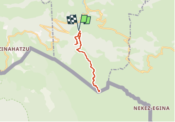

Length
12.2 km

Max alt
887 m

Uphill gradient
660 m
Km-Effort
21 km

Min alt
351 m

Downhill gradient
661 m
Boucle
Yes
Creation date :
2022-07-07 07:50:15.527
Updated on :
2022-07-07 11:35:09.557
3h38
Difficulty : Medium

FREE GPS app for hiking
 SityTrail
IGN / Geographical institutes
SityTrail Plus
The world is yours!
About
Trail Walking of 12.2 km to be discovered at New Aquitaine, Pyrénées-Atlantiques, Estérençuby. This trail is proposed by Fab-Oz.
Description
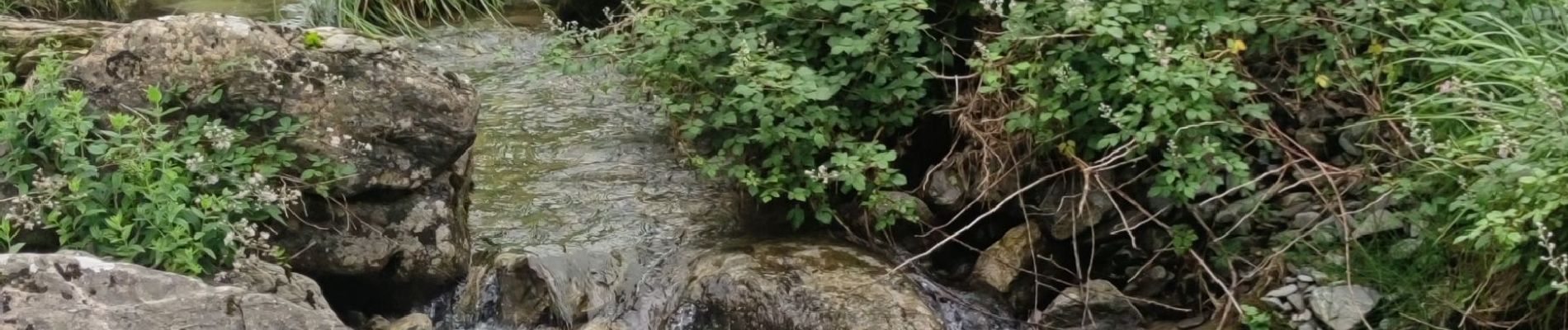
Aller-retour de la Source de la Nive jusqu'à la grotte Hapea
Sentier pas vraiment balisé mais très bien tracé
Photos

Positioning
Country:
France
Region :
New Aquitaine
Department/Province :
Pyrénées-Atlantiques
Municipality :
Estérençuby
Location:
Unknown
Start:(Dec)
Start:(UTM)
647007 ; 4769532 (30T) N.
Comments