


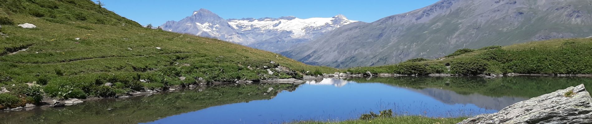
lac d'Arcelle

dcharbonnier
User
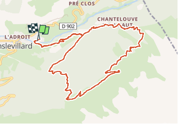

Length
14 km

Max alt
2297 m

Uphill gradient
848 m
Km-Effort
25 km

Min alt
1481 m

Downhill gradient
837 m
Boucle
Yes
Creation date :
2022-07-08 07:11:12.071
Updated on :
2022-07-08 13:34:17.001
5h33
Difficulty : Difficult

FREE GPS app for hiking
 SityTrail
IGN / Geographical institutes
SityTrail Plus
The world is yours!
About
Trail Walking of 14 km to be discovered at Auvergne-Rhône-Alpes, Savoy, Val-Cenis. This trail is proposed by dcharbonnier.
Description
pierres sculptées chapelle St Agathe.
Photos


Positioning
Country:
France
Region :
Auvergne-Rhône-Alpes
Department/Province :
Savoy
Municipality :
Val-Cenis
Location:
Lanslevillard
Start:(Dec)
Start:(UTM)
336970 ; 5017319 (32T) N.
Comments