Trail Walking Saint-Dalmas-le-Selvage - St Delmas de Selvage aux cols de Braisse et Sanguiniere - Photo

St Delmas de Selvage aux cols de Braisse et Sanguiniere

 GrouGary
GrouGary

User

© OpenStreetMap contributors
Length
Length
11.7 km
Max alt
Max alt
2602 m
Uphill gradient
Uphill gradient
719 m
Km-Effort
Km-Effort  
21 km
Min alt
Min alt
1980 m
Downhill gradient
Downhill gradient
714 m
Boucle
Boucle
Yes
Creation date :
2022-07-08 07:37:57.345
Updated on :
2023-08-06 17:31:08.849

(0 Reviews)

Walking
Walking
4h18
Difficulty : Easy

Scan this QR Code to open this trail in the SityTrail application

FREE GPS app for hiking

Logo SityTrail SityTrail

IGN / Geographical institutes

Download SityTrail from the App Store Download SityTrail from Google Play

Logo SityTrail SityTrail World

The world is yours!

Download SityTrail from the App Store Download SityTrail from Google Play Download SityTrail on Huawei AppGallery

About

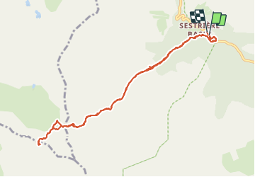
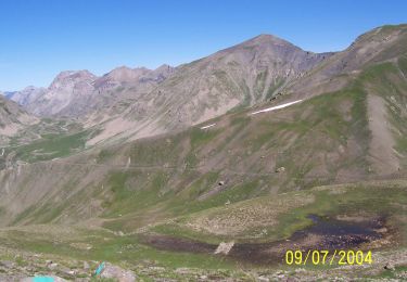
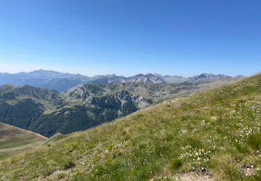
Trail Walking of 11.7 km to be discovered at Provence-Alpes-Côte d'Azur, Maritime Alps, Saint-Dalmas-le-Selvage. This trail is proposed by GrouGary.

Description

A/R - 17°C a 9h AM, 7 juillet
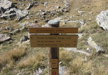
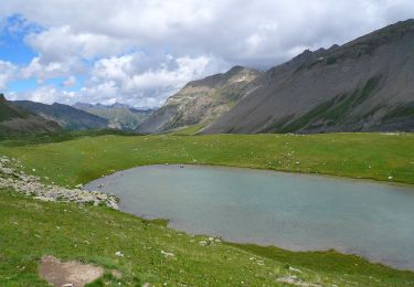
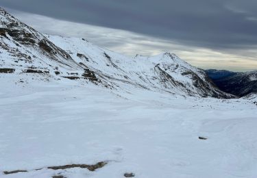
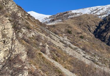
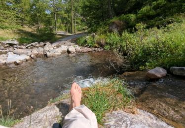
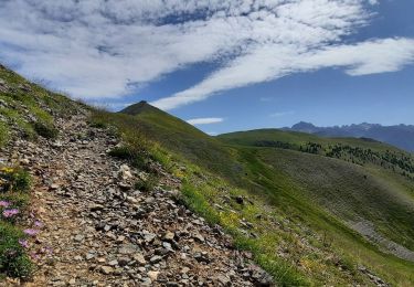
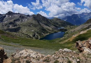
A/R du refuge de Sestrière - Montée le long du torrent, en sous-bois, vers col de BraÏssa puis col de la Sanguinière. Aucune difficulté technique.

Variante possible :
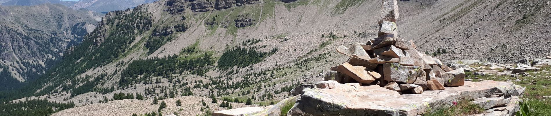
Au col de la Braïssa, prendre le pendre le sentier à flanc de la Tête de la Clape, monter en zigzag sous le col de cime plate puis col de l'Escuzier : faire le tour de la Tête de Cristel (RANDO SPORTIVE)

Elevation profile

Photos

Positioning

Country:
France
Region :
Provence-Alpes-Côte d'Azur
Department/Province :
Maritime Alps
Municipality :
Saint-Dalmas-le-Selvage
Location:
Unknown
Start:(UTM)
326338 ; 4906863 (32T) N.

Trails nearby

Trail On foot Uvernet-Fours - Pointe de Colombart - Photo
On foot
PRO

On foot

Easy
Uvernet-Fours, Provence-Alpes-Côte d'Azur, Alpes-de-Haute-Provence, France
8.1 km | 11.7 km-effort
2h 40min
Yes
Trail On foot Saint-Dalmas-le-Selvage - Col de Gialorgues - Photo
On foot
PRO

On foot

Easy
Saint-Dalmas-le-Selvage, Provence-Alpes-Côte d'Azur, Maritime Alps, France
9.8 km | 17 km-effort
3h 52min
Yes
Trail On foot Saint-Dalmas-le-Selvage - Crête de la Blanche - Photo
On foot
PRO

On foot

Medium
Saint-Dalmas-le-Selvage, Provence-Alpes-Côte d'Azur, Maritime Alps, France
12 km | 20 km-effort
4h 33min
Yes
Trail Snowshoes Saint-Dalmas-le-Selvage - Col de la Moutière - Photo
Snowshoes
bozo1970

Snowshoes

Medium
Saint-Dalmas-le-Selvage, Provence-Alpes-Côte d'Azur, Maritime Alps, France
17.8 km | 30 km-effort
5h 3min
Yes
Trail Snowshoes Saint-Dalmas-le-Selvage - Tête de Vinaigre  - Photo
Snowshoes
bozo1970

Snowshoes

Medium
Saint-Dalmas-le-Selvage, Provence-Alpes-Côte d'Azur, Maritime Alps, France
10.5 km | 22 km-effort
4h 22min
Yes
Trail Walking Saint-Dalmas-le-Selvage - Sestrieres - col de Braïssa - Photo
Walking
patsure

Walking

Difficult
Saint-Dalmas-le-Selvage, Provence-Alpes-Côte d'Azur, Maritime Alps, France
9.4 km | 17.9 km-effort
3h 12min
Yes
Trail Walking Saint-Dalmas-le-Selvage - Le Castel de la Tour - Photo
Walking
bozo1970

Walking

Very difficult
Saint-Dalmas-le-Selvage, Provence-Alpes-Côte d'Azur, Maritime Alps, France
10.5 km | 23 km-effort
5h 38min
Yes
Trail Walking Saint-Dalmas-le-Selvage - Crête de la Blanche - Photo
Walking
GuyVachet

Walking

Very difficult
Saint-Dalmas-le-Selvage, Provence-Alpes-Côte d'Azur, Maritime Alps, France
18.2 km | 30 km-effort
7h 21min
Yes
Trail Walking Saint-Dalmas-le-Selvage - Refuge de Vens par les Aiguilles de Tortisse - Photo
Walking
GuyVachet

Walking

Very difficult
Saint-Dalmas-le-Selvage, Provence-Alpes-Côte d'Azur, Maritime Alps, France
11.3 km | 23 km-effort
5h 35min
No


Close
My subscriptions