


GR10T13/7/22

LouisROGER
User GUIDE

Length
2.3 km

Max alt
1612 m

Uphill gradient
392 m
Km-Effort
6.3 km

Min alt
1219 m

Downhill gradient
14 m
Boucle
No
Creation date :
2022-07-13 08:12:06.691
Updated on :
2022-07-14 16:48:55.806
3h52
Difficulty : Medium

FREE GPS app for hiking
 SityTrail
IGN / Geographical institutes
SityTrail Plus
The world is yours!
About
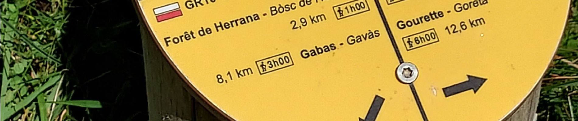
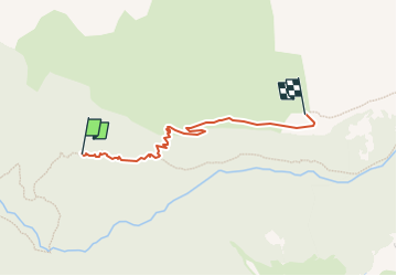
Trail Walking of 2.3 km to be discovered at New Aquitaine, Pyrénées-Atlantiques, Laruns. This trail is proposed by LouisROGER.
Photos


Positioning
Country:
France
Region :
New Aquitaine
Department/Province :
Pyrénées-Atlantiques
Municipality :
Laruns
Location:
Unknown
Start:(Dec)
Start:(UTM)
711352 ; 4754014 (30T) N.
Comments