


2022-07-15 Marche Refuge Baerenkopf Auberge Gazon Vert

holtzv
User GUIDE
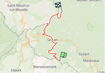


8h21
Difficulty : Very difficult

FREE GPS app for hiking
 SityTrail
IGN / Geographical institutes
SityTrail Plus
The world is yours!
About
Trail Walking of 23 km to be discovered at Grand Est, Haut-Rhin, Kirchberg. This trail is proposed by holtzv.
Description
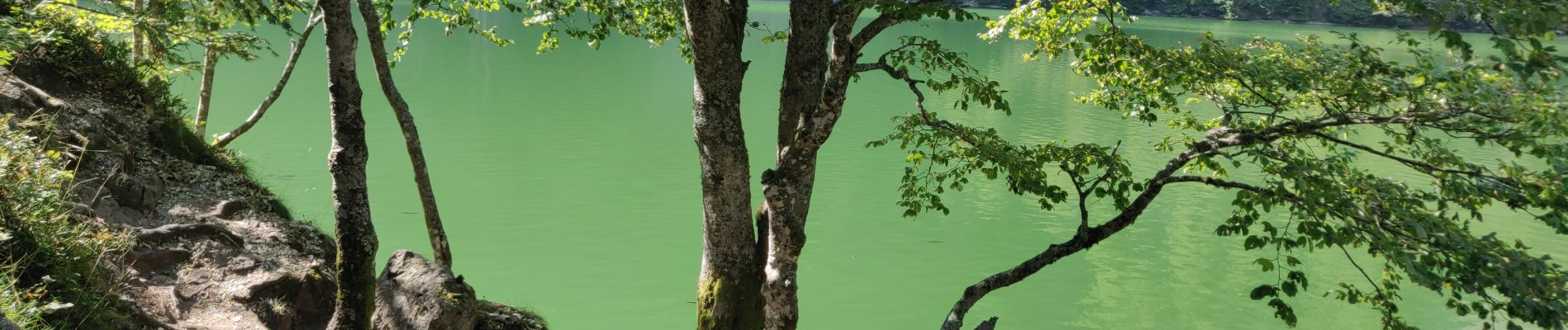
De retour à la ferme auberge du Lochberg pour prendre le petit déjeuner. Passage ensuite par la source de la Doller, les nouveaux gites de la Fennematt, la vue sur le Rossberg, l’abri du Graber Breitenstein, l’auberge du Graber en rénovation, le rocher Hunfels avec la vue sur Sewen, le lac de Sewen, le déjeuner à la ferme Baerenbach, la roche de l’enfer, le chemin des bornes de la Haute Bers, le pré de la Haute Bers, le rocher du Corbeau, le lac des Perches (ou SternSee), le gite du Gazon Vert pour le diner et nuitée.
Photos


Positioning
Comments