


PARC NATIONAL DES ECRINS: LACS DE CRUPILOUSE

djeepee74
User
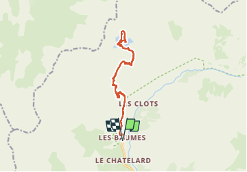

Length
17.4 km

Max alt
2722 m

Uphill gradient
1447 m
Km-Effort
37 km

Min alt
1339 m

Downhill gradient
1446 m
Boucle
Yes
Creation date :
2022-07-15 05:59:39.315
Updated on :
2022-07-17 15:15:00.913
7h24
Difficulty : Very difficult

FREE GPS app for hiking
 SityTrail
IGN / Geographical institutes
SityTrail Plus
The world is yours!
About
Trail Walking of 17.4 km to be discovered at Provence-Alpes-Côte d'Azur, Hautes-Alpes, Champoléon. This trail is proposed by djeepee74.
Description
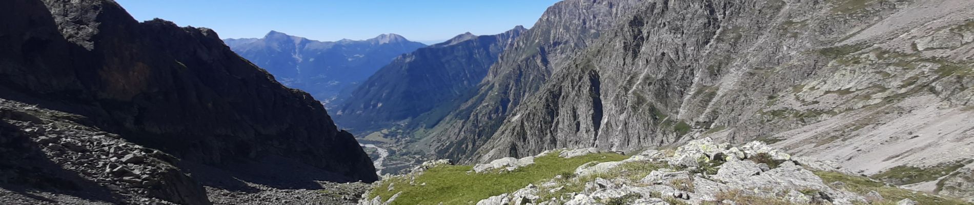
ALLER / RETOUR... live de Cris & Karine le 20220715
départ: " les Baumes "
long... aride... mais belle récompense avec les nombreux lacs !
Photos


Positioning
Country:
France
Region :
Provence-Alpes-Côte d'Azur
Department/Province :
Hautes-Alpes
Municipality :
Champoléon
Location:
Unknown
Start:(Dec)
Start:(UTM)
282125 ; 4957403 (32T) N.
Comments