


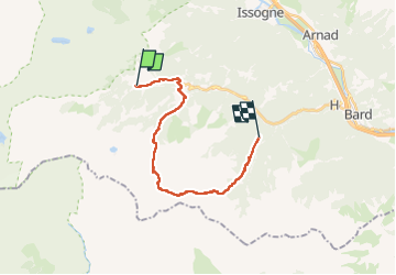
Alta via val d’Aoste2 etape8 (Champorcher-Crest)

philvidal
User

Length
18.7 km

Max alt
2560 m

Uphill gradient
1417 m
Km-Effort
39 km

Min alt
1129 m

Downhill gradient
1702 m
Boucle
No
Creation date :
2022-07-16 05:50:05.0
Updated on :
2022-07-22 18:23:30.192
6h09
Difficulty : Very difficult

FREE GPS app for hiking
 SityTrail
IGN / Geographical institutes
SityTrail Plus
The world is yours!
About
Trail Walking of 18.7 km to be discovered at Aosta Valley, Unknown, Champorcher. This trail is proposed by philvidal.
Positioning
Country:
Italy
Region :
Aosta Valley
Department/Province :
Unknown
Municipality :
Champorcher
Location:
Unknown
Start:(Dec)
Start:(UTM)
391419 ; 5052973 (32T) N.
Comments