


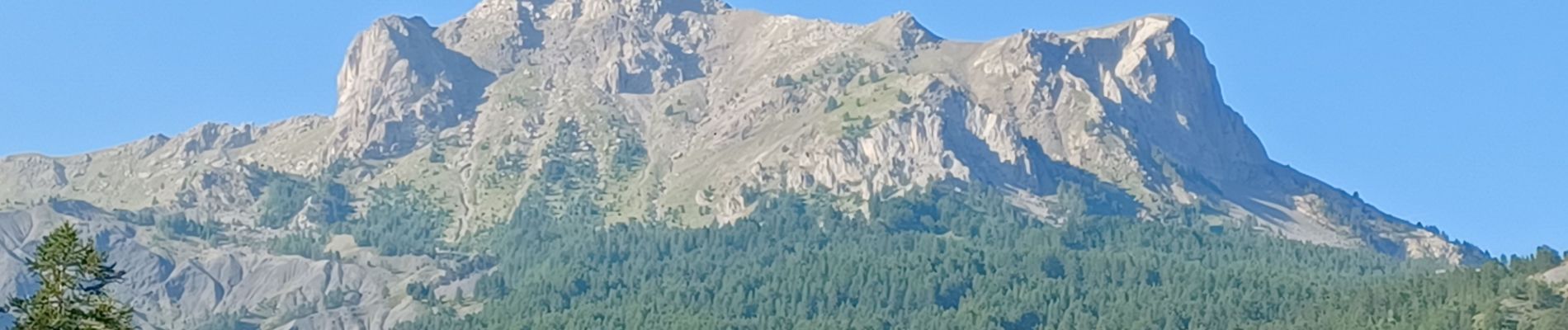
ENCHASTRAYES le Sauze . balade du Vivier o

RobinMicheline
User GUIDE
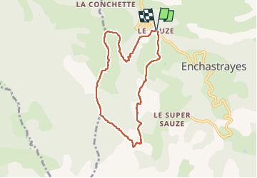

Length
7.6 km

Max alt
1740 m

Uphill gradient
410 m
Km-Effort
13.1 km

Min alt
1347 m

Downhill gradient
404 m
Boucle
Yes
Creation date :
2022-07-17 06:55:31.021
Updated on :
2022-07-24 17:06:46.947
2h29
Difficulty : Easy

FREE GPS app for hiking
 SityTrail
IGN / Geographical institutes
SityTrail Plus
The world is yours!
About
Trail Walking of 7.6 km to be discovered at Provence-Alpes-Côte d'Azur, Alpes-de-Haute-Provence, Enchastrayes. This trail is proposed by RobinMicheline.
Photos


Positioning
Country:
France
Region :
Provence-Alpes-Côte d'Azur
Department/Province :
Alpes-de-Haute-Provence
Municipality :
Enchastrayes
Location:
Unknown
Start:(Dec)
Start:(UTM)
315312 ; 4915931 (32T) N.
Comments