


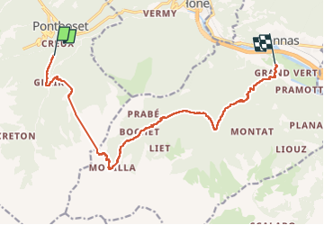
Alta via val d’Aoste2 etape9 (Crest-Donnas)

philvidal
User

Length
14.9 km

Max alt
2098 m

Uphill gradient
1016 m
Km-Effort
31 km

Min alt
316 m

Downhill gradient
1859 m
Boucle
No
Creation date :
2022-07-17 02:45:37.0
Updated on :
2022-07-22 18:29:57.94
4h22
Difficulty : Difficult

FREE GPS app for hiking
 SityTrail
IGN / Geographical institutes
SityTrail Plus
The world is yours!
About
Trail Walking of 14.9 km to be discovered at Aosta Valley, Unknown, Pontboset. This trail is proposed by philvidal.
Positioning
Country:
Italy
Region :
Aosta Valley
Department/Province :
Unknown
Municipality :
Pontboset
Location:
Unknown
Start:(Dec)
Start:(UTM)
397379 ; 5050396 (32T) N.
Comments