


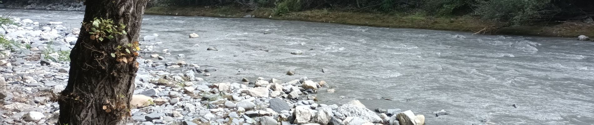
Cascade du Morel-20-07-22

Christiancordin
User
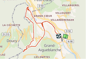

Length
12.1 km

Max alt
632 m

Uphill gradient
282 m
Km-Effort
15.9 km

Min alt
435 m

Downhill gradient
283 m
Boucle
Yes
Creation date :
2022-07-20 06:59:28.881
Updated on :
2022-07-25 15:57:46.152
2h38
Difficulty : Medium

FREE GPS app for hiking
 SityTrail
IGN / Geographical institutes
SityTrail Plus
The world is yours!
About
Trail Walking of 12.1 km to be discovered at Auvergne-Rhône-Alpes, Savoy, Grand-Aigueblanche. This trail is proposed by Christiancordin.
Description
Aigueblanche-sentier du Morel-Bellecombe Tarentaise-cascade du Morel-St Oyen-établissement Thermal de la Léchère les Bains-retour le long de l'Isère.
Photos


Positioning
Country:
France
Region :
Auvergne-Rhône-Alpes
Department/Province :
Savoy
Municipality :
Grand-Aigueblanche
Location:
Aigueblanche
Start:(Dec)
Start:(UTM)
305169 ; 5041753 (32T) N.
Comments