Trail Walking Saulzet-le-Froid - Saulzet_Froid_Vallon_Ribeyre - Photo
 jagarnier
jagarnier

User GUIDE

© OpenStreetMap contributors
Length
Length
14.6 km
Max alt
Max alt
1038 m
Uphill gradient
Uphill gradient
244 m
Km-Effort
Km-Effort  
17.8 km
Min alt
Min alt
873 m
Downhill gradient
Downhill gradient
244 m
Boucle
Boucle
Yes
Creation date :
2022-07-21 08:30:31.982
Updated on :
2022-07-21 11:57:24.11

(0 Reviews)

Walking
Walking
4h15
Difficulty : Medium

Scan this QR Code to open this trail in the SityTrail application

FREE GPS app for hiking

Logo SityTrail SityTrail

IGN / Geographical institutes

Download SityTrail from the App Store Download SityTrail from Google Play

Logo SityTrail SityTrail World

The world is yours!

Download SityTrail from the App Store Download SityTrail from Google Play Download SityTrail on Huawei AppGallery

About

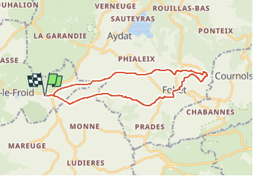
Trail Walking of 14.6 km to be discovered at Auvergne-Rhône-Alpes, Puy-de-Dôme, Saulzet-le-Froid. This trail is proposed by jagarnier.

Description

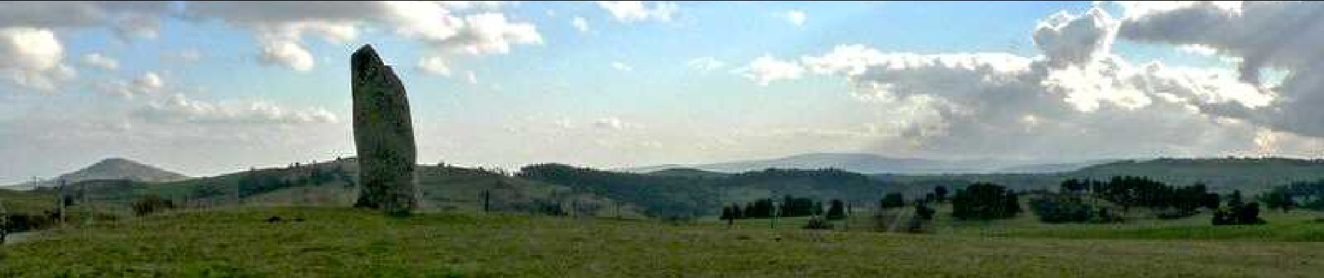
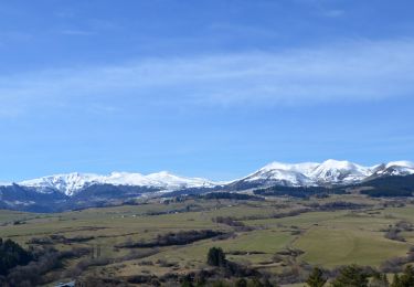
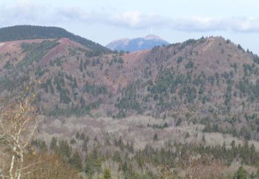
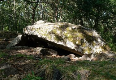
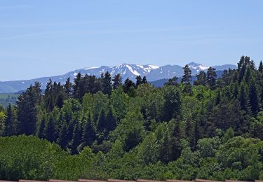
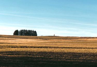
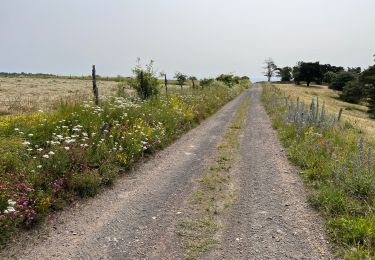
Une première partie de la randonnée se fait sur le haut du plateau. De belles vues sur la Chaîne des Puys et les Monts Dores, jusqu'au menhir de Fohet dit de Pierre longue. qui marque le début de collines parsemées de chaos rocheux. Retour par le fond du vallon, en longeant le ruisseau de la Ribeyre.

Elevation profile

Photos

Positioning

Country:
France
Region :
Auvergne-Rhône-Alpes
Department/Province :
Puy-de-Dôme
Municipality :
Saulzet-le-Froid
Location:
Unknown
Start:(UTM)
495282 ; 5054085 (31T) N.

Trails nearby

Trail Walking Le Vernet-Sainte-Marguerite - Vernet_Puy_Alou - Photo
Walking
GUIDE
jagarnier

Walking

Medium
(1)
Le Vernet-Sainte-Marguerite, Auvergne-Rhône-Alpes, Puy-de-Dôme, France
9.9 km | 13.1 km-effort
2h 50min
Yes
Trail Walking Aydat - LacAydatVeyreras_T - Photo
Walking
force

Walking

Very easy
(1)
Aydat, Auvergne-Rhône-Alpes, Puy-de-Dôme, France
11.1 km | 14.2 km-effort
3h 6min
Yes
Trail Walking Saulzet-le-Froid - Le Puy Baladou - Photo
Walking
Gegetop

Walking

Easy
(3)
Saulzet-le-Froid, Auvergne-Rhône-Alpes, Puy-de-Dôme, France
12.5 km | 17.3 km-effort
2h 54min
Yes
Trail Walking Aydat - puy de Vichatel - Photo
Walking
bernardeau

Walking

Very easy
(1)
Aydat, Auvergne-Rhône-Alpes, Puy-de-Dôme, France
3.8 km | 5.8 km-effort
1h 13min
Yes
Trail On foot Le Vernet-Sainte-Marguerite - Le Puy d'Alou - Photo
On foot
PRO

On foot

Easy
Le Vernet-Sainte-Marguerite, Auvergne-Rhône-Alpes, Puy-de-Dôme, France
9.3 km | 12 km-effort
2h 43min
Yes
Trail On foot Aydat - Le Lac de la Cassière - Photo
On foot
PRO

On foot

Easy
Aydat, Auvergne-Rhône-Alpes, Puy-de-Dôme, France
3.2 km | 4 km-effort
54min
Yes
Trail Walking Aydat - Fohet_Landes - Photo
Walking
GUIDE
jagarnier

Walking

Medium
(1)
Aydat, Auvergne-Rhône-Alpes, Puy-de-Dôme, France
13.1 km | 16.8 km-effort
4h 0min
Yes
Trail Walking Le Vernet-Sainte-Marguerite - Autour du Puy d’Alou - Photo
Walking
Dalma Chuck

Walking

Medium
Le Vernet-Sainte-Marguerite, Auvergne-Rhône-Alpes, Puy-de-Dôme, France
5.6 km | 7 km-effort
1h 11min
Yes
Trail Walking Le Vernet-Sainte-Marguerite - Le Puy d’Alou - Photo
Walking
Dalma Chuck

Walking

Medium
Le Vernet-Sainte-Marguerite, Auvergne-Rhône-Alpes, Puy-de-Dôme, France
6.1 km | 8 km-effort
1h 15min
Yes


Close
My subscriptions