


Thorens-plateau des Glières

mrcat
User
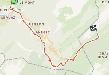

Length
15.7 km

Max alt
1446 m

Uphill gradient
964 m
Km-Effort
26 km

Min alt
654 m

Downhill gradient
243 m
Boucle
No
Creation date :
2022-07-21 04:23:00.133
Updated on :
2022-07-21 11:17:04.751
6h26
Difficulty : Difficult

FREE GPS app for hiking
 SityTrail
IGN / Geographical institutes
SityTrail Plus
The world is yours!
About
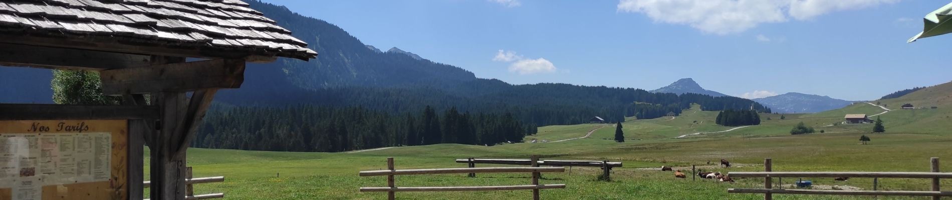
Trail Walking of 15.7 km to be discovered at Auvergne-Rhône-Alpes, Upper Savoy, Fillière. This trail is proposed by mrcat.
Photos

Positioning
Country:
France
Region :
Auvergne-Rhône-Alpes
Department/Province :
Upper Savoy
Municipality :
Fillière
Location:
Thorens-Glières
Start:(Dec)
Start:(UTM)
287072 ; 5097474 (32T) N.
Comments