


73 mottet drayeres

trietsch
User
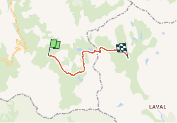

Length
7.8 km

Max alt
2583 m

Uphill gradient
460 m
Km-Effort
13.8 km

Min alt
2127 m

Downhill gradient
409 m
Boucle
No
Creation date :
2022-07-24 09:12:45.857
Updated on :
2022-07-24 09:14:18.974
3h07
Difficulty : Difficult

FREE GPS app for hiking
 SityTrail
IGN / Geographical institutes
SityTrail Plus
The world is yours!
About
Trail Walking of 7.8 km to be discovered at Auvergne-Rhône-Alpes, Savoy, Valloire. This trail is proposed by trietsch.
Positioning
Country:
France
Region :
Auvergne-Rhône-Alpes
Department/Province :
Savoy
Municipality :
Valloire
Location:
Unknown
Start:(Dec)
Start:(UTM)
299474 ; 4995316 (32T) N.
Comments