


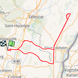
Beblenheim - Wittisheim - Beblenheim

Schnacka
User


4h25
Difficulty : Easy

FREE GPS app for hiking
 SityTrail
IGN / Geographical institutes
SityTrail Plus
The world is yours!
About
Trail Cycle of 71 km to be discovered at Grand Est, Haut-Rhin, Beblenheim. This trail is proposed by Schnacka.
Description
Beau circuit cyclable qui rejoint le canal du Rhone au Rhin et son chemin de halage aménagé.
Petite halte repas possible la Coccinelle à Artzenheim au bord du canal, et halte aux Jardins de Gaïa à Wittisheim pour une dégustation de thés.


Positioning
Comments