


2022 07 24

lr80
User

Length
17 km

Max alt
1877 m

Uphill gradient
897 m
Km-Effort
29 km

Min alt
1192 m

Downhill gradient
892 m
Boucle
Yes
Creation date :
2022-07-24 05:09:29.467
Updated on :
2022-07-24 19:14:45.556
5h56
Difficulty : Difficult

FREE GPS app for hiking
 SityTrail
IGN / Geographical institutes
SityTrail Plus
The world is yours!
About
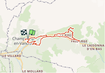
Trail Walking of 17 km to be discovered at Auvergne-Rhône-Alpes, Savoy, Champagny-en-Vanoise. This trail is proposed by lr80.
Description
champagny 01
Positioning
Country:
France
Region :
Auvergne-Rhône-Alpes
Department/Province :
Savoy
Municipality :
Champagny-en-Vanoise
Location:
Unknown
Start:(Dec)
Start:(UTM)
320146 ; 5036252 (32T) N.
Comments