


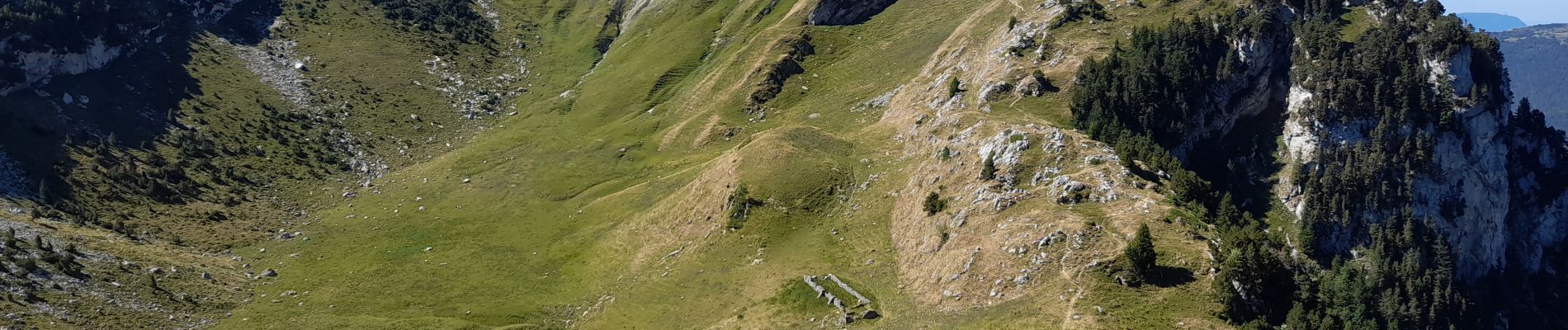
BAUGES: DENT DE ROSSANAZ

djeepee74
User

Length
11.7 km

Max alt
1872 m

Uphill gradient
1065 m
Km-Effort
26 km

Min alt
915 m

Downhill gradient
1064 m
Boucle
Yes
Creation date :
2022-07-30 16:21:54.231
Updated on :
2022-07-30 16:51:23.378
5h30
Difficulty : Medium

FREE GPS app for hiking
 SityTrail
IGN / Geographical institutes
SityTrail Plus
The world is yours!
About
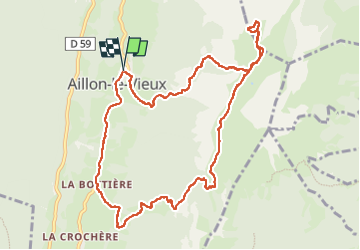
Trail Walking of 11.7 km to be discovered at Auvergne-Rhône-Alpes, Savoy, Aillon-le-Vieux. This trail is proposed by djeepee74.
Description
BOUCLE... live le 20220730.
Photos


Positioning
Country:
France
Region :
Auvergne-Rhône-Alpes
Department/Province :
Savoy
Municipality :
Aillon-le-Vieux
Location:
Unknown
Start:(Dec)
Start:(UTM)
273640 ; 5059485 (32T) N.
Comments