Trail Walking Nickenich - Promenade autour du Laacher See - Photo

« L’heure de la fin des découvertes ne sonne jamais. » Colette GUIDE+

© OpenStreetMap contributors
Length
Length
8.6 km
Max alt
Max alt
318 m
Uphill gradient
Uphill gradient
102 m
Km-Effort
Km-Effort  
10 km
Min alt
Min alt
274 m
Downhill gradient
Downhill gradient
101 m
Boucle
Boucle
Yes
Creation date :
2022-08-01 20:52:26.506
Updated on :
2022-08-03 20:53:22.07

(0 Reviews)

Walking
Walking
2h16
Difficulty : Medium

Scan this QR Code to open this trail in the SityTrail application

FREE GPS app for hiking

Logo SityTrail SityTrail

IGN / Geographical institutes

Download SityTrail from the App Store Download SityTrail from Google Play

Logo SityTrail SityTrail World

The world is yours!

Download SityTrail from the App Store Download SityTrail from Google Play Download SityTrail on Huawei AppGallery

About

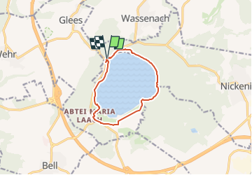
Trail Walking of 8.6 km to be discovered at Rhineland-Palatinate, Landkreis Mayen-Koblenz, Nickenich. This trail is proposed by Au fil de nos découvertes.

Description

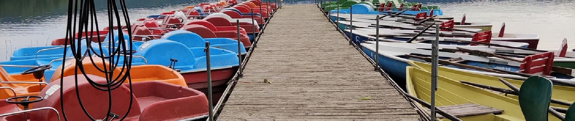
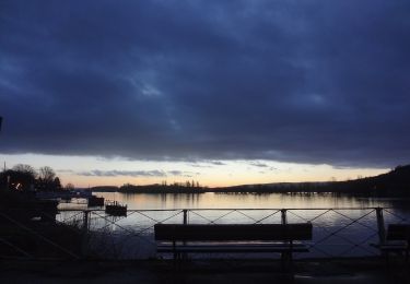
Le plus grand lac volcanique de l'Eifel. 😱
🅿️ Départ et Parking
Parkplatz
56645 Nickenich, Allemagne  
- Il existe plusieurs distances
🚶Niveau facile
▶️ Suivre la balise "Laacher See"
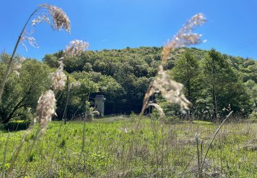
Cette randonnée mène autour du Laacher See, le plus grand lac volcanique de l'Eifel. Vous alternerez entre vues sur le lac et promenade en forêt.
Faites un détour par l'Abbaye de Maria Laach, qui est assez impressionnante avec son très joli parc. ⛪🌳
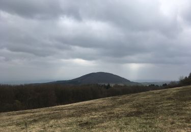
Ainsi que par " Tour Lydia". De cette tour d'observation, vous pouvez profiter d'une vue impressionnante sur le Laacher See et le paysage de l'Eifel, par temps clair jusqu'au Siebengebirge.
Possibilités de pique-niquer. 🥪🍴
Chiens autorisés en laisse. 🐩🐶🐕
Convient pour les enfants . 👱👱‍♂️  
Convient pour les poussettes et personnes à mobilité réduite. 👨‍🦽👩‍🦽👶
N'hésitez pas à aller faire un tour sur notre site internet et nos réseaux :
www.aufildenosdecouvertes.com
www.facebook.com/aufildenosdecouvertes
https://www.instagram.com/au_fil_de_nos_decouvertes  

Elevation profile

Photos

Positioning

Country:
Germany
Region :
Rhineland-Palatinate
Department/Province :
Landkreis Mayen-Koblenz
Municipality :
Nickenich
Location:
Unknown
Start:(UTM)
376503 ; 5586876 (32U) N.

Trails nearby

Trail On foot Mendig - Vier-Berge-Tour - Photo
On foot
PRO

On foot

Easy
Mendig, Rhineland-Palatinate, Landkreis Mayen-Koblenz, Germany
4.6 km | 6 km-effort
1h 21min
No
Trail On foot Nickenich - Pellenzer Seepfad - Photo
On foot
PRO

On foot

Medium
Nickenich, Rhineland-Palatinate, Landkreis Mayen-Koblenz, Germany
16 km | 23 km-effort
5h 14min
Yes
Trail On foot Andernach - Traumpfad Höhlen- und Schluchtensteig Kell - Photo
On foot
PRO

On foot

Easy
Andernach, Rhineland-Palatinate, Landkreis Mayen-Koblenz, Germany
8.7 km | 11.5 km-effort
2h 37min
No
Trail Walking Andernach - Hölen und Schluchtensteig Kell - Photo
Walking
Hein De Vries

Walking

Medium
Andernach, Rhineland-Palatinate, Landkreis Mayen-Koblenz, Germany
12.5 km | 17 km-effort
4h 56min
Yes
Trail Walking Nickenich - near Laacher See  - Photo
Walking
Hein De Vries

Walking

Medium
Nickenich, Rhineland-Palatinate, Landkreis Mayen-Koblenz, Germany
7.1 km | 9.4 km-effort
2h 34min
Yes


Close
My subscriptions