


arves

JPS73
User
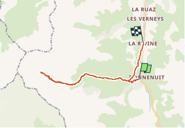

Length
15.1 km

Max alt
2554 m

Uphill gradient
888 m
Km-Effort
27 km

Min alt
1586 m

Downhill gradient
1007 m
Boucle
No
Creation date :
2022-08-02 06:52:13.114
Updated on :
2022-08-02 14:28:19.758
4h56
Difficulty : Very difficult

FREE GPS app for hiking
 SityTrail
IGN / Geographical institutes
SityTrail Plus
The world is yours!
About
Trail Walking of 15.1 km to be discovered at Auvergne-Rhône-Alpes, Savoy, Valloire. This trail is proposed by JPS73.
Positioning
Country:
France
Region :
Auvergne-Rhône-Alpes
Department/Province :
Savoy
Municipality :
Valloire
Location:
Unknown
Start:(Dec)
Start:(UTM)
296778 ; 4999481 (32T) N.
Comments