


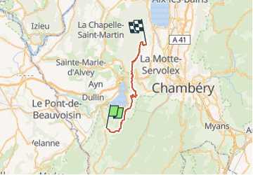
CHA - J5 - 14/09 - Attignat Oncin > La Serraz

aeldin
User

Length
23 km

Max alt
1071 m

Uphill gradient
1212 m
Km-Effort
40 km

Min alt
336 m

Downhill gradient
1416 m
Boucle
No
Creation date :
2022-08-04 06:47:13.77
Updated on :
2022-09-08 19:20:04.95
20m
Difficulty : Easy

FREE GPS app for hiking
 SityTrail
IGN / Geographical institutes
SityTrail Plus
The world is yours!
About
Trail Horseback riding of 23 km to be discovered at Auvergne-Rhône-Alpes, Savoy, Attignat-Oncin. This trail is proposed by aeldin.

Positioning
Country:
France
Region :
Auvergne-Rhône-Alpes
Department/Province :
Savoy
Municipality :
Attignat-Oncin
Location:
Unknown
Start:(Dec)
Start:(UTM)
716428 ; 5043471 (31T) N.
Comments