


randonnée Philippe

Malvina lauvernier
User
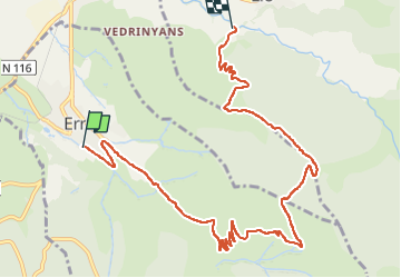

Length
10.8 km

Max alt
2050 m

Uphill gradient
690 m
Km-Effort
19.9 km

Min alt
1360 m

Downhill gradient
679 m
Boucle
No
Creation date :
2022-08-09 07:51:19.008
Updated on :
2022-08-09 13:17:38.224
3h16
Difficulty : Very difficult

FREE GPS app for hiking
 SityTrail
IGN / Geographical institutes
SityTrail Plus
The world is yours!
About
Trail Walking of 10.8 km to be discovered at Occitania, Pyrénées-Orientales, Err. This trail is proposed by Malvina lauvernier.
Description
Balade à partir du camping
Positioning
Country:
France
Region :
Occitania
Department/Province :
Pyrénées-Orientales
Municipality :
Err
Location:
Unknown
Start:(Dec)
Start:(UTM)
420574 ; 4698846 (31T) N.
Comments