


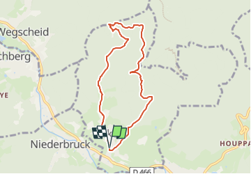
Parking Eglise/Mairie Sickert - Kuzakapalala - Rocher de la Croix - Col de Sickertbach - Abri du Sickertbach et retour

patrickbeyrath
User

Length
7 km

Max alt
748 m

Uphill gradient
325 m
Km-Effort
11.3 km

Min alt
428 m

Downhill gradient
326 m
Boucle
Yes
Creation date :
2022-08-11 08:40:56.657
Updated on :
2022-08-12 06:11:12.21
3h16
Difficulty : Medium

FREE GPS app for hiking
 SityTrail
IGN / Geographical institutes
SityTrail Plus
The world is yours!
About
Trail On foot of 7 km to be discovered at Grand Est, Haut-Rhin, Sickert. This trail is proposed by patrickbeyrath.
Positioning
Country:
France
Region :
Grand Est
Department/Province :
Haut-Rhin
Municipality :
Sickert
Location:
Unknown
Start:(Dec)
Start:(UTM)
348615 ; 5294128 (32T) N.
Comments