


Chamois Val d Aoste120722

guyernage25
User
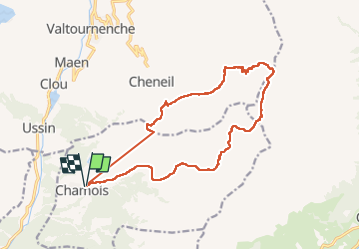

Length
16.9 km

Max alt
3184 m

Uphill gradient
1563 m
Km-Effort
38 km

Min alt
1836 m

Downhill gradient
1578 m
Boucle
Yes
Creation date :
2022-08-11 17:15:26.68
Updated on :
2022-08-12 17:21:48.569
8h13
Difficulty : Very difficult

FREE GPS app for hiking
 SityTrail
IGN / Geographical institutes
SityTrail Plus
The world is yours!
About
Trail Walking of 16.9 km to be discovered at Aosta Valley, Unknown, Chamois. This trail is proposed by guyernage25.
Description
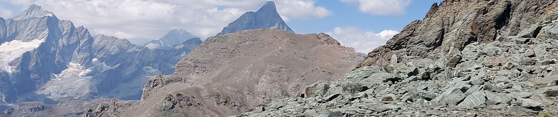
super randonnée montagnarde très difficile, avec l escalade du Petit Tournain très alpine. Descente très raide sur le col Di Nannaz
Photos


Positioning
Country:
Italy
Region :
Aosta Valley
Department/Province :
Unknown
Municipality :
Chamois
Location:
Unknown
Start:(Dec)
Start:(UTM)
392955 ; 5077137 (32T) N.
Comments