


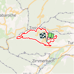
Frauenberg - Trois Epis - Meierhof - Obschel - Schellenkoenig - et retour

patrickbeyrath
User

Length
11.2 km

Max alt
777 m

Uphill gradient
559 m
Km-Effort
18.7 km

Min alt
311 m

Downhill gradient
558 m
Boucle
Yes
Creation date :
2018-10-13 05:52:57.619
Updated on :
2018-10-13 05:52:57.628
3h46
Difficulty : Medium

FREE GPS app for hiking
 SityTrail
IGN / Geographical institutes
SityTrail Plus
The world is yours!
About
Trail Walking of 11.2 km to be discovered at Grand Est, Haut-Rhin, Turckheim. This trail is proposed by patrickbeyrath.
Positioning
Country:
France
Region :
Grand Est
Department/Province :
Haut-Rhin
Municipality :
Turckheim
Location:
Unknown
Start:(Dec)
Start:(UTM)
369072 ; 5327607 (32U) N.
Comments