


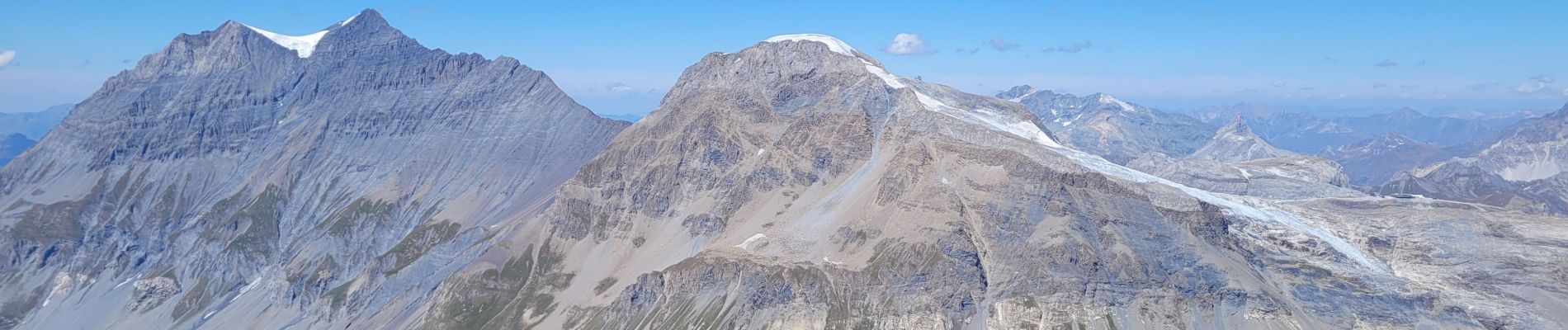
pointe de la Sana

amiral13
User GUIDE
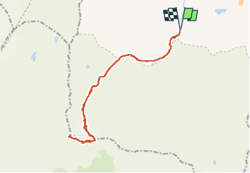

Length
18.6 km

Max alt
3413 m

Uphill gradient
1467 m
Km-Effort
38 km

Min alt
1942 m

Downhill gradient
1467 m
Boucle
Yes
Creation date :
2022-08-16 05:30:55.551
Updated on :
2022-08-17 15:51:15.929
10h38
Difficulty : Very difficult

FREE GPS app for hiking
 SityTrail
IGN / Geographical institutes
SityTrail Plus
The world is yours!
About
Trail Walking of 18.6 km to be discovered at Auvergne-Rhône-Alpes, Savoy, Val-d'Isère. This trail is proposed by amiral13.
Description
randonnée effectuée le 16 aout 2022.
attention ce parcours nécessite l'utilisation de crampons, ainsi qu'un bon sens de l'itinéraire.
Photos


Positioning
Country:
France
Region :
Auvergne-Rhône-Alpes
Department/Province :
Savoy
Municipality :
Val-d'Isère
Location:
Unknown
Start:(Dec)
Start:(UTM)
341381 ; 5031882 (32T) N.
Comments