


Col de Wettstein-Tanet-Musmiss-Col de Wettstein

maureengeorges
User
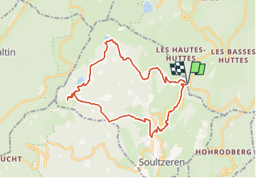

Length
16.4 km

Max alt
1171 m

Uphill gradient
718 m
Km-Effort
26 km

Min alt
582 m

Downhill gradient
714 m
Boucle
Yes
Creation date :
2022-08-22 15:05:59.289
Updated on :
2022-08-22 15:07:03.697
5h54
Difficulty : Very difficult

FREE GPS app for hiking
 SityTrail
IGN / Geographical institutes
SityTrail Plus
The world is yours!
About
Trail Walking of 16.4 km to be discovered at Grand Est, Haut-Rhin, Orbey. This trail is proposed by maureengeorges.
Positioning
Country:
France
Region :
Grand Est
Department/Province :
Haut-Rhin
Municipality :
Orbey
Location:
Unknown
Start:(Dec)
Start:(UTM)
359726 ; 5327772 (32U) N.
Comments