Trail Walking Vitrolles-en-Luberon - vitrolles en Lubéron. aire des mascas - Photo

vitrolles en Lubéron. aire des mascas

 Roger
Roger

User

© OpenStreetMap contributors
Length
Length
9.9 km
Max alt
Max alt
954 m
Uphill gradient
Uphill gradient
474 m
Km-Effort
Km-Effort  
16.2 km
Min alt
Min alt
476 m
Downhill gradient
Downhill gradient
477 m
Boucle
Boucle
Yes
Creation date :
2022-08-28 06:54:53.694
Updated on :
2022-08-28 10:27:42.674

(0 Reviews)

Walking
Walking
3h19
Difficulty : Medium

Scan this QR Code to open this trail in the SityTrail application

FREE GPS app for hiking

Logo SityTrail SityTrail

IGN / Geographical institutes

Download SityTrail from the App Store Download SityTrail from Google Play

Logo SityTrail SityTrail World

The world is yours!

Download SityTrail from the App Store Download SityTrail from Google Play Download SityTrail on Huawei AppGallery

About

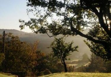
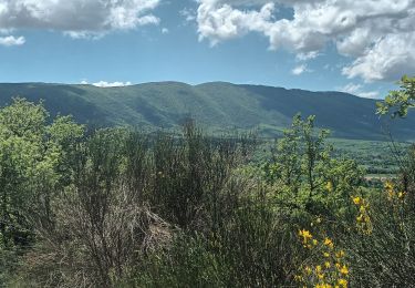
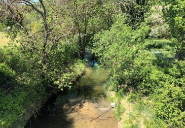
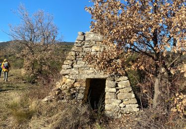
Trail Walking of 9.9 km to be discovered at Provence-Alpes-Côte d'Azur, Vaucluse, Vitrolles-en-Luberon. This trail is proposed by Roger .

Description

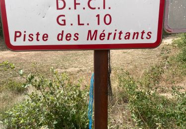
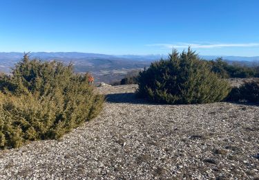
sommet de la combe par la piste.  retour par le ravin de Saint Jean  très pentu . fin de randonnée raide

Elevation profile

Photos

Positioning

Country:
France
Region :
Provence-Alpes-Côte d'Azur
Department/Province :
Vaucluse
Municipality :
Vitrolles-en-Luberon
Location:
Unknown
Start:(UTM)
707272 ; 4856148 (31T) N.

Trails nearby

Trail Cycle La Bastide-des-Jourdans - Parcours n°21 - La Bastide-des-Jourdans - Photo
Cycle
GUIDE+

Cycle

Medium
(2)
La Bastide-des-Jourdans, Provence-Alpes-Côte d'Azur, Vaucluse, France
40 km | 49 km-effort
2h 49min
Yes
Trail Walking Peypin-d'Aigues - peypin d'aygues - Photo
Walking
denizot

Walking

Easy
(1)
Peypin-d'Aigues, Provence-Alpes-Côte d'Azur, Vaucluse, France
11.6 km | 16.9 km-effort
3h 34min
Yes
Trail Walking Céreste - Colline de la Gardette-Céreste-08-05-23 - Photo
Walking
Christiancordin

Walking

Medium
Céreste, Provence-Alpes-Côte d'Azur, Alpes-de-Haute-Provence, France
8.1 km | 11.6 km-effort
2h 2min
Yes
Trail Walking Céreste - Cereste - Photo
Walking
Christiancordin

Walking

Medium
Céreste, Provence-Alpes-Côte d'Azur, Alpes-de-Haute-Provence, France
7.3 km | 9.1 km-effort
1h 56min
Yes
Trail Walking Peypin-d'Aigues - Peypin-d’Aigues d’Aigues les Dones nord - Photo
Walking
Dadou 1

Walking

Medium
Peypin-d'Aigues, Provence-Alpes-Côte d'Azur, Vaucluse, France
7.3 km | 11.5 km-effort
2h 41min
Yes
Trail Walking Vitrolles-en-Luberon - Mascas Mourre negre  - Photo
Walking
GUIDE
antignacs

Walking

Medium
Vitrolles-en-Luberon, Provence-Alpes-Côte d'Azur, Vaucluse, France
25 km | 35 km-effort
7h 1min
Yes
Trail Walking Céreste - Col des Mascas 84 - Photo
Walking
Dadou 1

Walking

Very easy
Céreste, Provence-Alpes-Côte d'Azur, Alpes-de-Haute-Provence, France
8.3 km | 11.9 km-effort
3h 45min
Yes
Trail Mountain bike Vitrolles-en-Luberon - GTVAU-J6 - Photo
Mountain bike
PhilippeC54

Mountain bike

Very easy
(1)
Vitrolles-en-Luberon, Provence-Alpes-Côte d'Azur, Vaucluse, France
48 km | 67 km-effort
Unknown
No
Trail Walking Céreste - Cereste-Montjustin - Photo
Walking
janussity

Walking

Medium
(1)
Céreste, Provence-Alpes-Côte d'Azur, Alpes-de-Haute-Provence, France
11.6 km | 15.8 km-effort
3h 12min
Yes


Close
My subscriptions