Trail Mountain bike Saint-Caprais-de-Bordeaux - St Caprais - Madirac - Photo
© OpenStreetMap contributors
Length
Length
33 km
Max alt
Max alt
100 m
Uphill gradient
Uphill gradient
637 m
Km-Effort
Km-Effort  
42 km
Min alt
Min alt
1 m
Downhill gradient
Downhill gradient
638 m
Boucle
Boucle
Yes
Creation date :
2014-12-10 00:00:00.0
Updated on :
2014-12-10 00:00:00.0

(1 Reviews)

Mountain bike
Mountain bike
2h43
Difficulty : Medium

Scan this QR Code to open this trail in the SityTrail application

FREE GPS app for hiking

Logo SityTrail SityTrail

IGN / Geographical institutes

Download SityTrail from the App Store Download SityTrail from Google Play

Logo SityTrail SityTrail World

The world is yours!

Download SityTrail from the App Store Download SityTrail from Google Play Download SityTrail on Huawei AppGallery

About

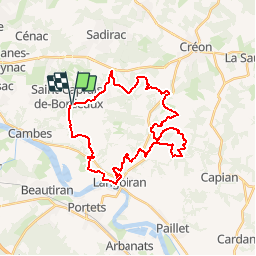
Trail Mountain bike of 33 km to be discovered at New Aquitaine, Gironde, Saint-Caprais-de-Bordeaux. This trail is proposed by FranckBag.

Description

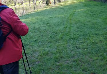
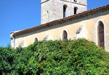
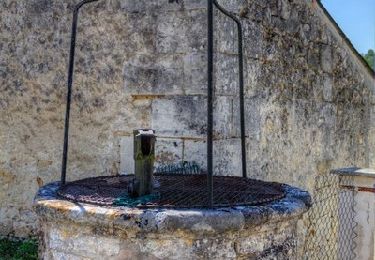
Une boucle entre Garonne et coteaux, sur chemins agricoles ou en forêt. Certains passages en sous-bois peuvent être compliqués par temps très humide, mais sinon, pas de difficultés majeures. Quelques montées assez raides, mais c'est ce qui fait le charme de ce coin-là...

Elevation profile

Positioning

Country:
France
Region :
New Aquitaine
Department/Province :
Gironde
Municipality :
Saint-Caprais-de-Bordeaux
Location:
Unknown
Start:(UTM)
703154 ; 4957951 (30T) N.

Comments

Please log in to post a review or rate the element


Une belle découverte des Premières Côtes, sur un parcours dessiné par quelqu'un qui connaît apparemment très bien la région !Sur un terrain détrempé comme nous l'avons eu, pas toujours facile. Mériterait donc d'être refait pas beau temps !


Trails nearby

Trail Walking Latresne -  Circuit des moulins à eau et à vent - Latresne - Photo
Walking
tracegps

Walking

Medium
Latresne, New Aquitaine, Gironde, France
6.7 km | 8 km-effort
2h 15min
Yes
Trail Walking Latresne -  Circuit Jean Balde - Latresne - Photo
Walking
tracegps

Walking

Medium
Latresne, New Aquitaine, Gironde, France
11.3 km | 13.2 km-effort
3h 30min
Yes
Trail Walking Ayguemorte-les-Graves - Sentier d'Ayguemorte les Graves - Photo
Walking
tracegps

Walking

Easy
Ayguemorte-les-Graves, New Aquitaine, Gironde, France
4.2 km | 4.5 km-effort
1h 4min
Yes
Trail Walking Cénac - Autour de Cénac - Photo
Walking
tracegps

Walking

Medium
Cénac, New Aquitaine, Gironde, France
10.6 km | 13.3 km-effort
3h 0min
Yes
Trail Walking Le Tourne - langoiran - Photo
Walking
bedous

Walking

Easy
Le Tourne, New Aquitaine, Gironde, France
17.8 km | 24 km-effort
4h 12min
No
Trail Walking Latresne - cenac - Photo
Walking
JPLACANAU

Walking

Very easy
Latresne, New Aquitaine, Gironde, France
6.4 km | 8.1 km-effort
2h 48min
No
Trail Walking Cénac - Circuit des sources autour de la Pimpine- Latresne - Photo
Walking
tracegps

Walking

Easy
Cénac, New Aquitaine, Gironde, France
2.5 km | 3.2 km-effort
45min
Yes
Trail Walking Latresne - Circuit de Pardaillan - Latresne - Photo
Walking
tracegps

Walking

Easy
Latresne, New Aquitaine, Gironde, France
2.9 km | 3.7 km-effort
1h 0min
Yes
Trail Walking Isle-Saint-Georges - Sentier d'Isle Saint Georges - Photo
Walking
tracegps

Walking

Easy
Isle-Saint-Georges, New Aquitaine, Gironde, France
3.4 km | 3.6 km-effort
49min
Yes


Close
My subscriptions