Trail Walking Nice - Collines niçoises - Photo
 kenhava
kenhava

User

© OpenStreetMap contributors
Length
Length
21 km
Max alt
Max alt
687 m
Uphill gradient
Uphill gradient
818 m
Km-Effort
Km-Effort  
30 km
Min alt
Min alt
11 m
Downhill gradient
Downhill gradient
523 m
Boucle
Boucle
No
Creation date :
2014-12-10 00:00:00.0
Updated on :
2014-12-10 00:00:00.0

(1 Reviews)

Walking
Walking
6h32
Difficulty : Easy

Scan this QR Code to open this trail in the SityTrail application

FREE GPS app for hiking

Logo SityTrail SityTrail

IGN / Geographical institutes

Download SityTrail from the App Store Download SityTrail from Google Play

Logo SityTrail SityTrail World

The world is yours!

Download SityTrail from the App Store Download SityTrail from Google Play Download SityTrail on Huawei AppGallery

About

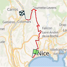
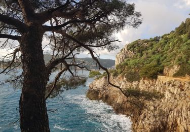
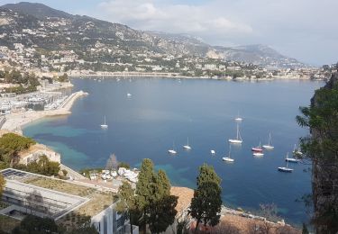
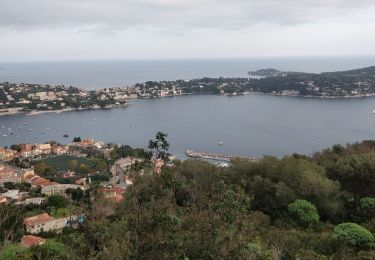
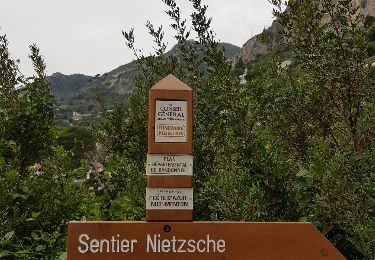
Trail Walking of 21 km to be discovered at Provence-Alpes-Côte d'Azur, Maritime Alps, Nice. This trail is proposed by kenhava.

Description

Une balade en marchant de la fac de lettres à l'Aire Saint Michel puis course tranquille jusqu'à Colomars

Elevation profile

Photos

Positioning

Country:
France
Region :
Provence-Alpes-Côte d'Azur
Department/Province :
Maritime Alps
Municipality :
Nice
Location:
Unknown
Start:(UTM)
358161 ; 4839224 (32T) N.

Comments

Please log in to post a review or rate the element


Trails nearby

Trail Walking Nice - Ballade chemin des douaniers Nice-Villefranche  - Photo
Walking
coriace

Walking

Very easy
(1)
Nice, Provence-Alpes-Côte d'Azur, Maritime Alps, France
7.9 km | 10.3 km-effort
2h 13min
No
Trail Walking Nice - Nice - Tour du Mont Boron - Photo
Walking
LightStalker

Walking

Easy
Nice, Provence-Alpes-Côte d'Azur, Maritime Alps, France
7.3 km | 10.5 km-effort
2h 48min
Yes
Trail Walking Nice - Balade Niçoise : Centre-Ville, Vieux-Nice, Le Port - Photo
Walking
LightStalker

Walking

Very easy
Nice, Provence-Alpes-Côte d'Azur, Maritime Alps, France
5.4 km | 7.2 km-effort
2h 30min
Yes
Trail Walking Nice - Vieux Nice- Beaulieu par la côte  - Photo
Walking
coriace

Walking

Easy
(1)
Nice, Provence-Alpes-Côte d'Azur, Maritime Alps, France
18.1 km | 23 km-effort
3h 57min
No
Trail Walking Nice - BORON - Photo
Walking
Benteux

Walking

Very easy
Nice, Provence-Alpes-Côte d'Azur, Maritime Alps, France
12.7 km | 17.5 km-effort
5h 51min
Yes
Trail Walking Nice - Nice Mont Boron, Mont Alban, cap de Nice - Photo
Walking
reneperrin

Walking

Easy
Nice, Provence-Alpes-Côte d'Azur, Maritime Alps, France
17.1 km | 22 km-effort
3h 59min
No
Trail On foot Nice - nice - Photo
On foot
Axelloceane

On foot

Very easy
(1)
Nice, Provence-Alpes-Côte d'Azur, Maritime Alps, France
10.7 km | 12.8 km-effort
3h 0min
Yes
Trail Other activity Nice - Nice Eze - Photo
Other activity
Renefrt

Other activity

Very easy
Nice, Provence-Alpes-Côte d'Azur, Maritime Alps, France
15.8 km | 25 km-effort
6h 44min
No
Trail Running Nice - --Nice-- OR-4841354:UTCAM2015_tracé final - Photo
Running
ldulbecco

Running

Very difficult
(1)
Nice, Provence-Alpes-Côte d'Azur, Maritime Alps, France
141 km | 276 km-effort
Unknown
No


Close
My subscriptions