Trail Walking Ceillac - Boucle crête du Riou Vert et  Col de Bramousse - Photo

Boucle crête du Riou Vert et Col de Bramousse

 gildascb
gildascb

User

© OpenStreetMap contributors
Length
Length
8.3 km
Max alt
Max alt
2376 m
Uphill gradient
Uphill gradient
695 m
Km-Effort
Km-Effort  
17.6 km
Min alt
Min alt
1715 m
Downhill gradient
Downhill gradient
696 m
Boucle
Boucle
Yes
Creation date :
2022-08-31 06:44:37.295
Updated on :
2022-09-01 07:16:25.447

(0 Reviews)

Walking
Walking
4h03
Difficulty : Medium

Scan this QR Code to open this trail in the SityTrail application

FREE GPS app for hiking

Logo SityTrail SityTrail

IGN / Geographical institutes

Download SityTrail from the App Store Download SityTrail from Google Play

Logo SityTrail SityTrail World

The world is yours!

Download SityTrail from the App Store Download SityTrail from Google Play Download SityTrail on Huawei AppGallery

About

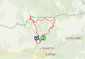
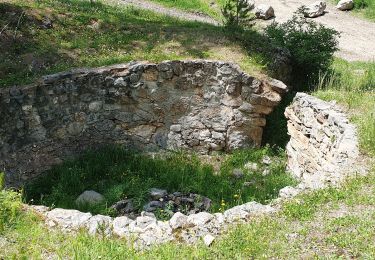
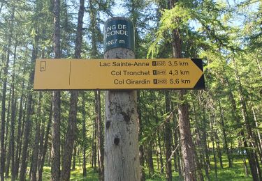
Trail Walking of 8.3 km to be discovered at Provence-Alpes-Côte d'Azur, Hautes-Alpes, Ceillac. This trail is proposed by gildascb.

Description

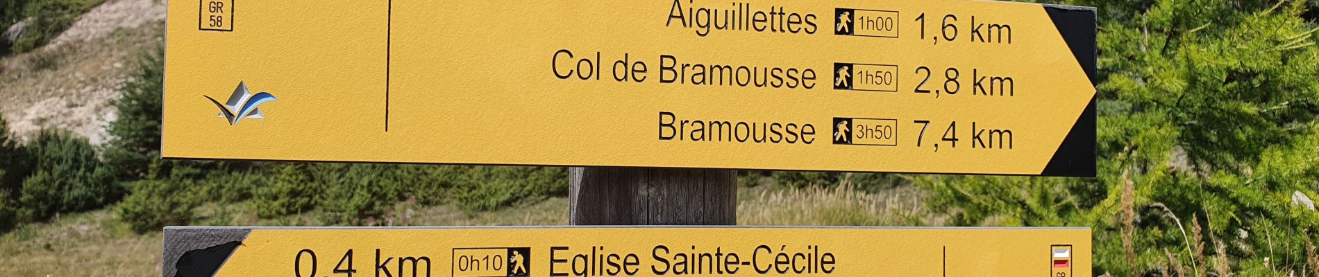
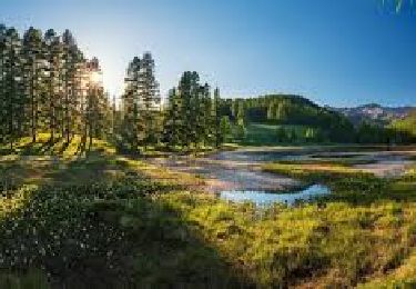
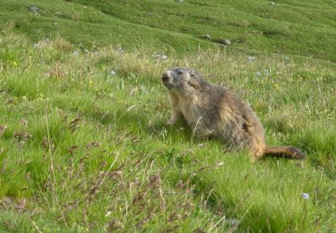
Boucle en  partie hors sentier balisé los de l'ascension (mais trace bien visible et de nombreux cairns qui garantissent de ne pas se perdre :-). Permet de s'éloigner des sentiers battus et de voir plus d'animaux (marmottes, chamois). Au sommet des crêtes, vue magnifique sur les différentes vallées qui débouchent à Ceillac, les Chalets de Bramousse, chalets de Furfande, Bramousse, etc. Puis passage par le col de Bramousse et le GR58 qui redescend à Ceillac.
Bonnie promenade!

Elevation profile

Photos

27 photos in total. Please click on a photo to see them all in the gallery.

Positioning

Country:
France
Region :
Provence-Alpes-Côte d'Azur
Department/Province :
Hautes-Alpes
Municipality :
Ceillac
Location:
Unknown
Start:(UTM)
323265 ; 4949152 (32T) N.

Trails nearby

Trail Walking Ceillac - Crêtes de Chambrettes - Photo
Walking
GUIDE
amiral13

Walking

Medium
(1)
Ceillac, Provence-Alpes-Côte d'Azur, Hautes-Alpes, France
13.4 km | 26 km-effort
5h 53min
Yes
Trail Walking Ceillac - 05 Tour Font Sancte - étape 1 - Photo
Walking
Maryma

Walking

Very difficult
(1)
Ceillac, Provence-Alpes-Côte d'Azur, Hautes-Alpes, France
16.5 km | 36 km-effort
8h 9min
No
Trail Walking Ceillac - Ceillac - St Véran - Photo
Walking
GUIDE
romanceline

Walking

Medium
Ceillac, Provence-Alpes-Côte d'Azur, Hautes-Alpes, France
13.5 km | 28 km-effort
7h 22min
No
Trail Walking Ceillac - la pointe de la Saume (traversée) - Photo
Walking
GUIDE
amiral13

Walking

Difficult
Ceillac, Provence-Alpes-Côte d'Azur, Hautes-Alpes, France
15 km | 34 km-effort
6h 43min
No
Trail Walking Ceillac - Lac Ste Anne et Tête de Girardin - Photo
Walking
GUIDE
amiral13

Walking

Medium
Ceillac, Provence-Alpes-Côte d'Azur, Hautes-Alpes, France
14.4 km | 27 km-effort
5h 48min
Yes
Trail Walking Ceillac - #1 Queyras 3j étape 1 Ceillac - Lac de Roue - Photo
Walking
Liobric

Walking

Very difficult
Ceillac, Provence-Alpes-Côte d'Azur, Hautes-Alpes, France
16.7 km | 33 km-effort
7h 34min
No
Trail Walking Ceillac - Arvieux Randonnée - Photo
Walking
choumac08

Walking

Very difficult
Ceillac, Provence-Alpes-Côte d'Azur, Hautes-Alpes, France
138 km | 250 km-effort
56h 55min
Yes
Trail Walking Ceillac - circuit des fours à chaux - Photo
Walking
marchev

Walking

Easy
Ceillac, Provence-Alpes-Côte d'Azur, Hautes-Alpes, France
7 km | 9.3 km-effort
2h 27min
No
Trail Walking Ceillac - lac Saint Anne et Miroir - Photo
Walking
marchev

Walking

Medium
Ceillac, Provence-Alpes-Côte d'Azur, Hautes-Alpes, France
10.9 km | 18.5 km-effort
4h 14min
Yes


Close
My subscriptions