


Pierre au pied Lanslevillard

geoffrayLayeux
User

Length
17.3 km

Max alt
2745 m

Uphill gradient
1140 m
Km-Effort
32 km

Min alt
1645 m

Downhill gradient
1140 m
Boucle
Yes
Creation date :
2022-08-31 16:06:48.886
Updated on :
2022-08-31 16:06:50.29
7h22
Difficulty : Very difficult

FREE GPS app for hiking
 SityTrail
IGN / Geographical institutes
SityTrail Plus
The world is yours!
About
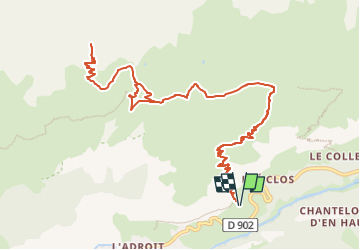
Trail Walking of 17.3 km to be discovered at Auvergne-Rhône-Alpes, Savoy, Val-Cenis. This trail is proposed by geoffrayLayeux.
Positioning
Country:
France
Region :
Auvergne-Rhône-Alpes
Department/Province :
Savoy
Municipality :
Val-Cenis
Location:
Lanslevillard
Start:(Dec)
Start:(UTM)
337816 ; 5017954 (32T) N.
Comments