


Pierre aux pied par le Collet

geoffrayLayeux
User
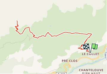

Length
15.3 km

Max alt
2745 m

Uphill gradient
1037 m
Km-Effort
29 km

Min alt
1756 m

Downhill gradient
1036 m
Boucle
Yes
Creation date :
2022-08-31 16:14:42.117
Updated on :
2022-08-31 16:14:43.428
6h37
Difficulty : Very difficult

FREE GPS app for hiking
 SityTrail
IGN / Geographical institutes
SityTrail Plus
The world is yours!
About
Trail Walking of 15.3 km to be discovered at Auvergne-Rhône-Alpes, Savoy, Val-Cenis. This trail is proposed by geoffrayLayeux.
Positioning
Country:
France
Region :
Auvergne-Rhône-Alpes
Department/Province :
Savoy
Municipality :
Val-Cenis
Location:
Lanslevillard
Start:(Dec)
Start:(UTM)
339153 ; 5018611 (32T) N.
Comments