Trail Walking Valdeblore - La Colmiane : Mont Peipori - Photo
 ETMU5496
ETMU5496

User

© OpenStreetMap contributors
Length
Length
16 km
Max alt
Max alt
2658 m
Uphill gradient
Uphill gradient
1185 m
Km-Effort
Km-Effort  
32 km
Min alt
Min alt
1574 m
Downhill gradient
Downhill gradient
1186 m
Boucle
Boucle
Yes
Creation date :
2022-09-04 06:19:06.0
Updated on :
2022-09-08 15:50:03.171

(0 Reviews)

Walking
Walking
5h00
Difficulty : Difficult

Scan this QR Code to open this trail in the SityTrail application

FREE GPS app for hiking

Logo SityTrail SityTrail

IGN / Geographical institutes

Download SityTrail from the App Store Download SityTrail from Google Play

Logo SityTrail SityTrail World

The world is yours!

Download SityTrail from the App Store Download SityTrail from Google Play Download SityTrail on Huawei AppGallery

About

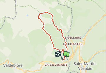
Trail Walking of 16 km to be discovered at Provence-Alpes-Côte d'Azur, Maritime Alps, Valdeblore. This trail is proposed by ETMU5496.

Description

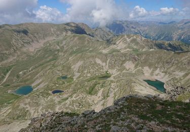
Point de départ : La Colmiane (1500) => Baus de la Frema (2246) => Tête du Brec (2266), Mont Pétoumier (2604) => Mont Pépoiri (2674) => Lacs du Clot Barrat => Parking de la Colmiane (1500) .
Le circuit s'effectue entièrement sur sentier (ou sente) balisé

Elevation profile

Photos

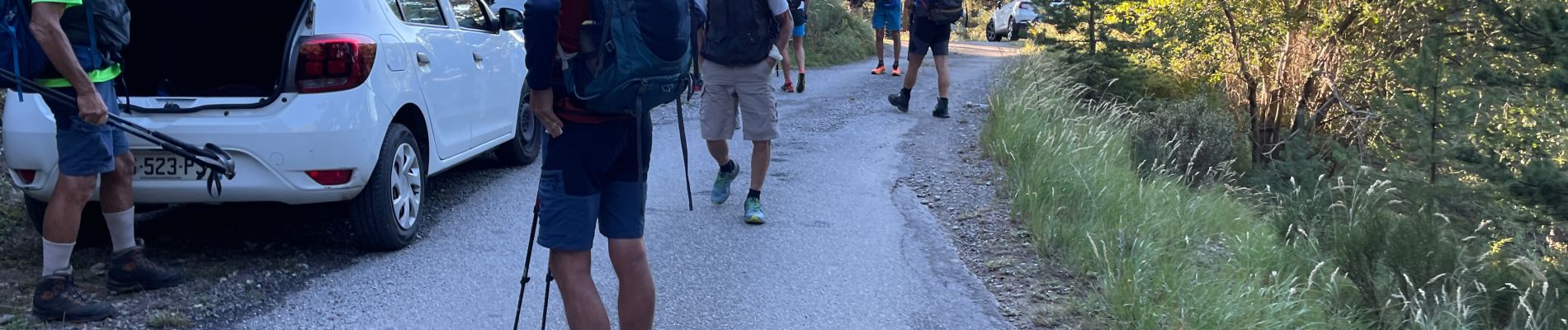
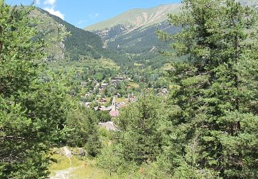
22 photos in total. Please click on a photo to see them all in the gallery.

Positioning

Country:
France
Region :
Provence-Alpes-Côte d'Azur
Department/Province :
Maritime Alps
Municipality :
Valdeblore
Location:
Unknown
Start:(Dec)
Start:(UTM)
358246 ; 4881715 (32T) N.

Trails nearby

Trail Walking Valdeblore - pepoiri  - Photo
Walking
REYPatrick

Walking

Very easy
(1)
Valdeblore, Provence-Alpes-Côte d'Azur, Maritime Alps, France
7.8 km | 16.3 km-effort
5h 31min
Yes
Trail Walking Venanson - La Malouna - Photo
Walking
Benteux

Walking

Medium
(1)
Venanson, Provence-Alpes-Côte d'Azur, Maritime Alps, France
10.7 km | 17.9 km-effort
5h 20min
Yes
Trail On foot Valdeblore - Le Caïre Gros - Photo
On foot
PRO

On foot

Medium
Valdeblore, Provence-Alpes-Côte d'Azur, Maritime Alps, France
9.8 km | 20 km-effort
4h 38min
Yes
Trail On foot Saint-Martin-Vésubie - Col de Cerise - Photo
On foot
PRO

On foot

Medium
Saint-Martin-Vésubie, Provence-Alpes-Côte d'Azur, Maritime Alps, France
9.7 km | 23 km-effort
5h 18min
Yes
Trail On foot Venanson - Circuit du Conquet - Photo
On foot
PRO

On foot

Medium
Venanson, Provence-Alpes-Côte d'Azur, Maritime Alps, France
10.2 km | 21 km-effort
4h 45min
Yes
Trail Walking Valdeblore - Lacs des Millefonts de col du Barn au col Ferriere - Photo
Walking
GrouGary

Walking

Easy
Valdeblore, Provence-Alpes-Côte d'Azur, Maritime Alps, France
9.3 km | 17.2 km-effort
3h 54min
Yes
Trail Walking Saint-Martin-Vésubie - Mont Pélago - Photo
Walking
bozo1970

Walking

Very difficult
Saint-Martin-Vésubie, Provence-Alpes-Côte d'Azur, Maritime Alps, France
7.7 km | 24 km-effort
6h 50min
Yes
Trail Walking Valdeblore - St Dalmas Valdeblore  - Photo
Walking
Daniel Benteux

Walking

Easy
Valdeblore, Provence-Alpes-Côte d'Azur, Maritime Alps, France
8.7 km | 12.3 km-effort
2h 26min
Yes
Trail Walking Venanson - Venanson - Photo
Walking
Jean-François Thibaud

Walking

Easy
Venanson, Provence-Alpes-Côte d'Azur, Maritime Alps, France
5.3 km | 9.1 km-effort
2h 48min
Yes


Close
My subscriptions