


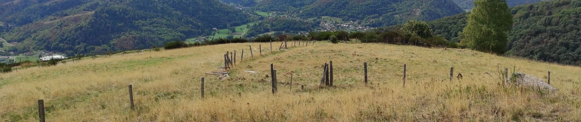
Ranspach abri S Huber

ROPPJP
User
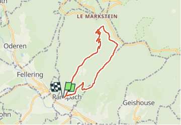

Length
13.5 km

Max alt
1049 m

Uphill gradient
654 m
Km-Effort
22 km

Min alt
439 m

Downhill gradient
656 m
Boucle
Yes
Creation date :
2022-09-07 07:05:07.627
Updated on :
2022-09-07 13:43:46.758
5h19
Difficulty : Very difficult

FREE GPS app for hiking
 SityTrail
IGN / Geographical institutes
SityTrail Plus
The world is yours!
About
Trail Walking of 13.5 km to be discovered at Grand Est, Haut-Rhin, Ranspach. This trail is proposed by ROPPJP.
Photos

Positioning
Country:
France
Region :
Grand Est
Department/Province :
Haut-Rhin
Municipality :
Ranspach
Location:
Unknown
Start:(Dec)
Start:(UTM)
351114 ; 5305492 (32T) N.
Comments