


TMB6 AN

reneperrin
User
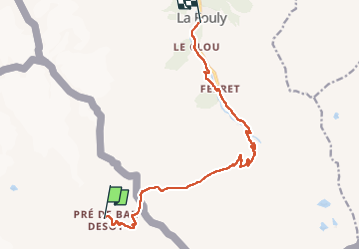

Length
12.6 km

Max alt
2532 m

Uphill gradient
507 m
Km-Effort
21 km

Min alt
1601 m

Downhill gradient
951 m
Boucle
No
Creation date :
2022-09-08 06:01:21.467
Updated on :
2022-09-08 12:38:46.174
4h05
Difficulty : Easy

FREE GPS app for hiking
 SityTrail
IGN / Geographical institutes
SityTrail Plus
The world is yours!
About
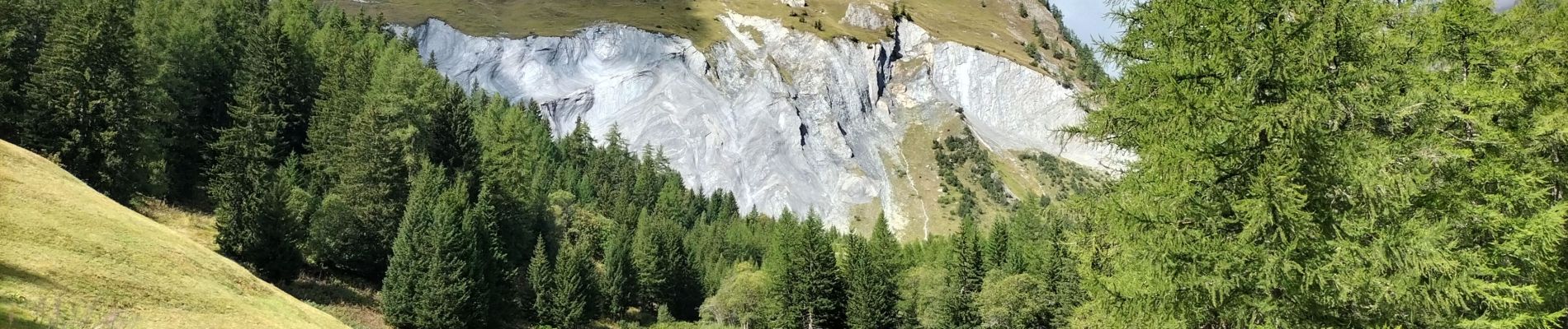
Trail Walking of 12.6 km to be discovered at Aosta Valley, Unknown, Courmayeur. This trail is proposed by reneperrin.
Photos


Positioning
Country:
Italy
Region :
Aosta Valley
Department/Province :
Unknown
Municipality :
Courmayeur
Location:
Unknown
Start:(Dec)
Start:(UTM)
349901 ; 5083086 (32T) N.
Comments