


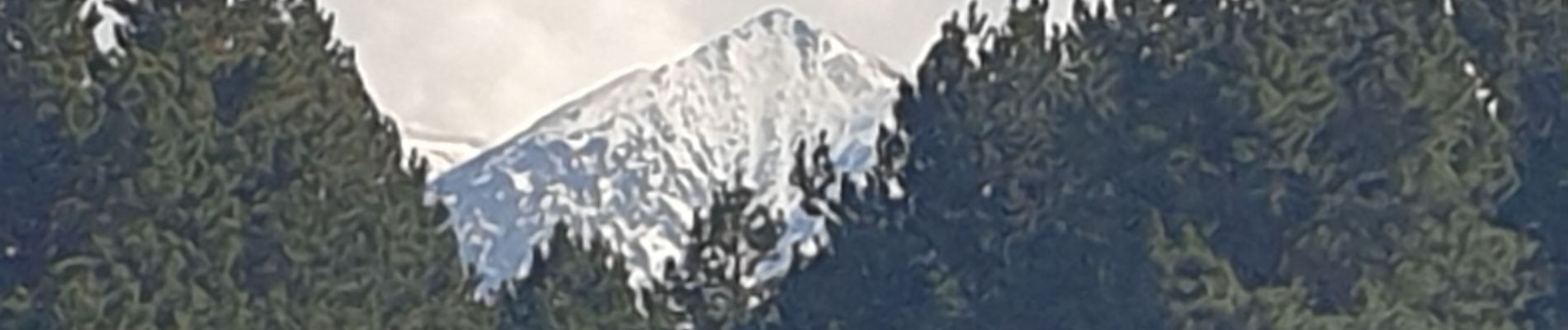
col de creux, de Sansa et de Torn

JMJ42
User
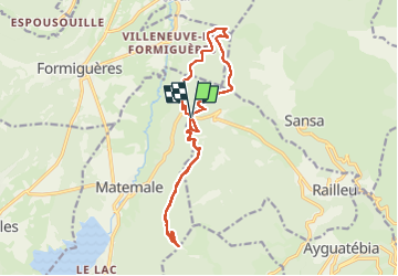

Length
17.3 km

Max alt
1903 m

Uphill gradient
514 m
Km-Effort
24 km

Min alt
1619 m

Downhill gradient
513 m
Boucle
Yes
Creation date :
2021-03-25 08:48:48.291
Updated on :
2022-09-09 14:45:54.545
4h36
Difficulty : Medium

FREE GPS app for hiking
 SityTrail
IGN / Geographical institutes
SityTrail Plus
The world is yours!
About
Trail Walking of 17.3 km to be discovered at Occitania, Pyrénées-Orientales, Railleu. This trail is proposed by JMJ42.
Photos


Positioning
Country:
France
Region :
Occitania
Department/Province :
Pyrénées-Orientales
Municipality :
Railleu
Location:
Unknown
Start:(Dec)
Start:(UTM)
429290 ; 4717045 (31T) N.
Comments