Trail Walking Saint-André - lac sous col de chavière - Photo

lac sous col de chavière

© OpenStreetMap contributors
Length
Length
14.8 km
Max alt
Max alt
2567 m
Uphill gradient
Uphill gradient
1010 m
Km-Effort
Km-Effort  
28 km
Min alt
Min alt
1772 m
Downhill gradient
Downhill gradient
1015 m
Boucle
Boucle
Yes
Creation date :
2022-09-11 06:54:04.205
Updated on :
2022-09-11 15:32:50.833

(0 Reviews)

Walking
Walking
5h23
Difficulty : Easy

Scan this QR Code to open this trail in the SityTrail application

FREE GPS app for hiking

Logo SityTrail SityTrail

IGN / Geographical institutes

Download SityTrail from the App Store Download SityTrail from Google Play

Logo SityTrail SityTrail World

The world is yours!

Download SityTrail from the App Store Download SityTrail from Google Play Download SityTrail on Huawei AppGallery

About

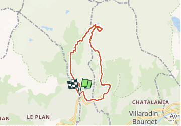
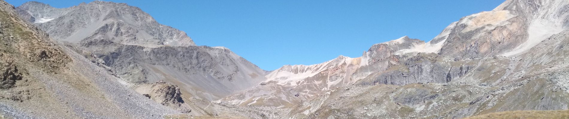
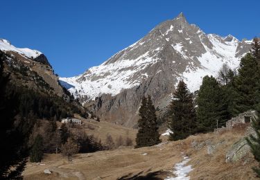
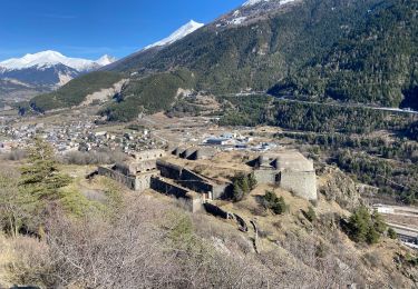
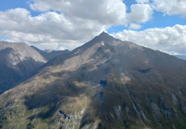
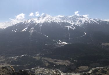
Trail Walking of 14.8 km to be discovered at Auvergne-Rhône-Alpes, Savoy, Saint-André. This trail is proposed by jibebouvier.

Description

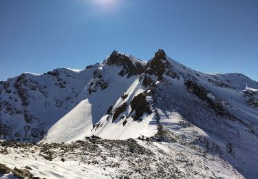
rando sympa, paysages grandioses.
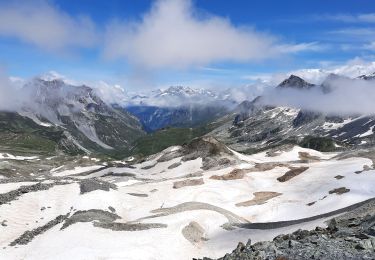
A faire plutôt dans l'autre sens pour mieux profiter de la vue
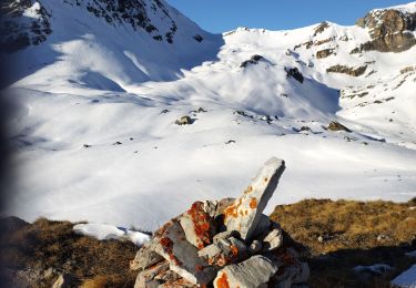
retour par la crête, pas fait le sommet de tête noire, il y avait un troupeau avec des patous sur le versant pour redescendre sur l'Orgere.
temps avec la pause au lac pour manger.

Elevation profile

Photos

Positioning

Country:
France
Region :
Auvergne-Rhône-Alpes
Department/Province :
Savoy
Municipality :
Saint-André
Location:
Unknown
Start:(UTM)
315623 ; 5010601 (32T) N.

Trails nearby

Trail On foot Villarodin-Bourget - Vallon de l'Orgère - Photo
On foot
PRO

On foot

Easy
Villarodin-Bourget, Auvergne-Rhône-Alpes, Savoy, France
4 km | 5.9 km-effort
1h 19min
No
Trail sport Fourneaux - Modane - Fort du Sapey AR - Photo
sport
erjot60

sport

Very easy
Fourneaux, Auvergne-Rhône-Alpes, Savoy, France
10.5 km | 19.2 km-effort
Unknown
Yes
Trail Walking Saint-André - St André -Le Col - Le Villard et retour  - Photo
Walking
erjot60

Walking

Medium
Saint-André, Auvergne-Rhône-Alpes, Savoy, France
6.6 km | 11.8 km-effort
3h 32min
Yes
Trail Walking Villarodin-Bourget - Parking Orgère en direction du Col de la Masse - Photo
Walking
yves12

Walking

Medium
Villarodin-Bourget, Auvergne-Rhône-Alpes, Savoy, France
8.4 km | 18.4 km-effort
4h 18min
Yes
Trail Touring skiing Villarodin-Bourget - passage de la belle Plinier Nord - Photo
Touring skiing
nadd73

Touring skiing

Medium
Villarodin-Bourget, Auvergne-Rhône-Alpes, Savoy, France
16 km | 37 km-effort
6h 1min
Yes
Trail Touring skiing Saint-André - Tête noire en boucle - Photo
Touring skiing
nadd73

Touring skiing

Medium
Saint-André, Auvergne-Rhône-Alpes, Savoy, France
26 km | 51 km-effort
8h 8min
Yes
Trail Nordic walking Villarodin-Bourget - pointe de la norma - Photo
Nordic walking
fb73300

Nordic walking

Difficult
Villarodin-Bourget, Auvergne-Rhône-Alpes, Savoy, France
10.4 km | 22 km-effort
5h 37min
Yes
Trail Walking Saint-André - lac de la Partie et col de Chavière - Photo
Walking
GuyVachet

Walking

Very difficult
Saint-André, Auvergne-Rhône-Alpes, Savoy, France
16.6 km | 31 km-effort
7h 36min
Yes
Trail Walking Modane - Modane le Barbier - Photo
Walking
yves12

Walking

Medium
Modane, Auvergne-Rhône-Alpes, Savoy, France
14.9 km | 32 km-effort
7h 28min
Yes


Close
My subscriptions