


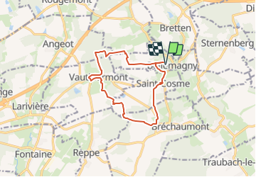
SityTrail - Bellemagny Vauthiermont

ruelwitt
User

Length
11.7 km

Max alt
423 m

Uphill gradient
178 m
Km-Effort
14.1 km

Min alt
340 m

Downhill gradient
178 m
Boucle
Yes
Creation date :
2022-09-11 17:08:37.551
Updated on :
2023-11-19 17:21:40.776
3h12
Difficulty : Difficult

FREE GPS app for hiking
 SityTrail
IGN / Geographical institutes
SityTrail Plus
The world is yours!
About
Trail Walking of 11.7 km to be discovered at Grand Est, Haut-Rhin, Bellemagny. This trail is proposed by ruelwitt.
Positioning
Country:
France
Region :
Grand Est
Department/Province :
Haut-Rhin
Municipality :
Bellemagny
Location:
Unknown
Start:(Dec)
Start:(UTM)
354731 ; 5283583 (32T) N.
Comments