


Formiguère refuge Camporells

taguette
User
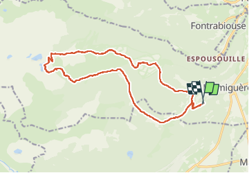

Length
19.7 km

Max alt
2415 m

Uphill gradient
884 m
Km-Effort
31 km

Min alt
1585 m

Downhill gradient
882 m
Boucle
Yes
Creation date :
2022-09-12 05:57:18.898
Updated on :
2022-09-12 13:13:26.966
5h46
Difficulty : Very difficult

FREE GPS app for hiking
 SityTrail
IGN / Geographical institutes
SityTrail Plus
The world is yours!
About
Trail Walking of 19.7 km to be discovered at Occitania, Pyrénées-Orientales, Formiguères. This trail is proposed by taguette.
Positioning
Country:
France
Region :
Occitania
Department/Province :
Pyrénées-Orientales
Municipality :
Formiguères
Location:
Unknown
Start:(Dec)
Start:(UTM)
425305 ; 4717659 (31T) N.
Comments