


refuge Cortalet sommet Canigou etap2

taguette
User
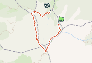

Length
7.3 km

Max alt
2753 m

Uphill gradient
536 m
Km-Effort
15.1 km

Min alt
2153 m

Downhill gradient
736 m
Boucle
No
Creation date :
2022-09-21 06:56:52.98
Updated on :
2022-09-21 12:54:51.14
4h05
Difficulty : Difficult

FREE GPS app for hiking
 SityTrail
IGN / Geographical institutes
SityTrail Plus
The world is yours!
About
Trail Walking of 7.3 km to be discovered at Occitania, Pyrénées-Orientales, Taurinya. This trail is proposed by taguette.
Description
attention manque 1,2km et 185m positif. Déclenchement du comptage trop tard. Attention itinéraire par la cheminée, escalade.
Positioning
Country:
France
Region :
Occitania
Department/Province :
Pyrénées-Orientales
Municipality :
Taurinya
Location:
Unknown
Start:(Dec)
Start:(UTM)
456451 ; 4708447 (31T) N.
Comments