


Taurinya

taguette
User
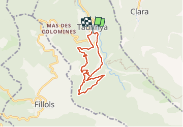

Length
7.4 km

Max alt
851 m

Uphill gradient
376 m
Km-Effort
12.4 km

Min alt
557 m

Downhill gradient
373 m
Boucle
Yes
Creation date :
2022-09-23 09:34:03.409
Updated on :
2022-09-23 11:55:05.83
2h19
Difficulty : Difficult

FREE GPS app for hiking
 SityTrail
IGN / Geographical institutes
SityTrail Plus
The world is yours!
About
Trail Walking of 7.4 km to be discovered at Occitania, Pyrénées-Orientales, Taurinya. This trail is proposed by taguette.
Positioning
Country:
France
Region :
Occitania
Department/Province :
Pyrénées-Orientales
Municipality :
Taurinya
Location:
Unknown
Start:(Dec)
Start:(UTM)
452967 ; 4714262 (31T) N.
Comments