Trail Walking Loire-sur-Rhône - 69-loire-sur-rhone2-pet-de-loup-18km-560m - Photo

69-loire-sur-rhone2-pet-de-loup-18km-560m

 SyMA
SyMA

User

© OpenStreetMap contributors
Length
Length
17.7 km
Max alt
Max alt
560 m
Uphill gradient
Uphill gradient
556 m
Km-Effort
Km-Effort  
25 km
Min alt
Min alt
330 m
Downhill gradient
Downhill gradient
558 m
Boucle
Boucle
Yes
Creation date :
2022-09-26 06:54:15.862
Updated on :
2022-09-26 16:03:22.998

(1 Reviews)

Walking
Walking
3h03
Difficulty : Medium

Scan this QR Code to open this trail in the SityTrail application

FREE GPS app for hiking

Logo SityTrail SityTrail

IGN / Geographical institutes

Download SityTrail from the App Store Download SityTrail from Google Play

Logo SityTrail SityTrail World

The world is yours!

Download SityTrail from the App Store Download SityTrail from Google Play Download SityTrail on Huawei AppGallery

About

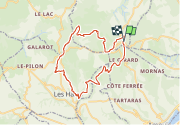
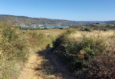
Trail Walking of 17.7 km to be discovered at Auvergne-Rhône-Alpes, Rhône, Loire-sur-Rhône. This trail is proposed by SyMA.

Description

petit parking le long de D502
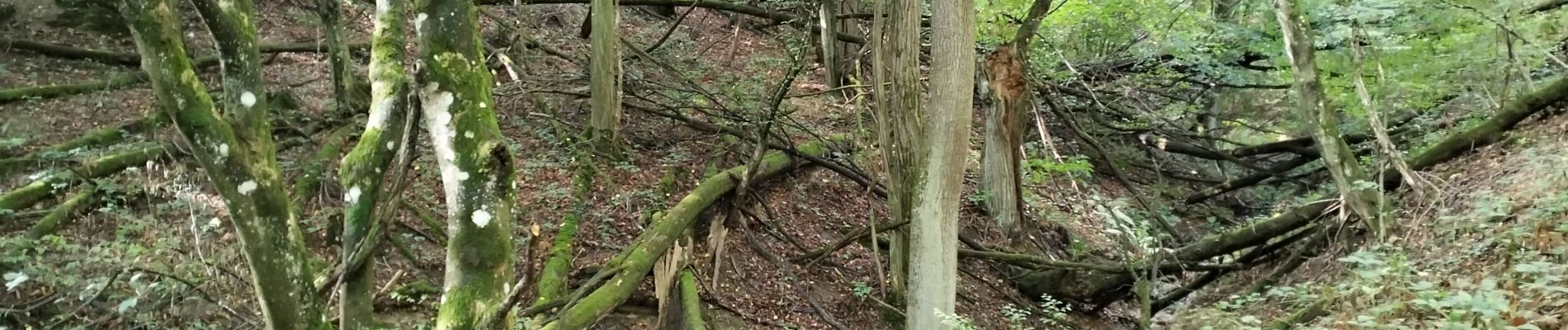
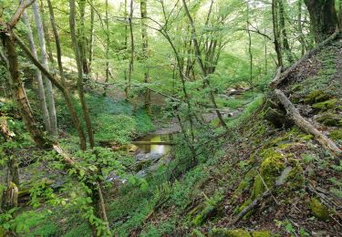
Belle rando mélangeant montées /descentes
Panoramas
Difficile à faire en VTT car beaucoup de chemins creusés.
pique-nique  possible Croix Regis (10km) ou avant à la Vierge (9.5km)

Elevation profile

Photos

Positioning

Country:
France
Region :
Auvergne-Rhône-Alpes
Department/Province :
Rhône
Municipality :
Loire-sur-Rhône
Location:
Unknown
Start:(UTM)
639528 ; 5043281 (31T) N.

Comments

Please log in to post a review or rate the element


Trails nearby

Trail Walking Saint-Romain-en-Gal - le grisard - Photo
Walking
servemichel

Walking

Medium
(1)
Saint-Romain-en-Gal, Auvergne-Rhône-Alpes, Rhône, France
5.3 km | 7.9 km-effort
1h 48min
Yes
Trail Walking Loire-sur-Rhône - 69-Loire-sur-Rhone-17km-480m-avr22 - Photo
Walking
SyMA

Walking

Medium
Loire-sur-Rhône, Auvergne-Rhône-Alpes, Rhône, France
16.7 km | 23 km-effort
5h 9min
Yes
Trail On foot La Chapelle-Villars - Pilat N°30: des «Côteaux à les Haies» - Photo
On foot
PRO

On foot

Difficult
La Chapelle-Villars, Auvergne-Rhône-Alpes, Loire, France
29 km | 37 km-effort
8h 27min
Yes
Trail Walking Ampuis - AMPUIS JC - Photo
Walking
Clubléorando

Walking

Very easy
(1)
Ampuis, Auvergne-Rhône-Alpes, Rhône, France
9.7 km | 12.1 km-effort
3h 10min
Yes
Trail Mountain bike Reventin-Vaugris - Écureuil 2013 - Photo
Mountain bike
marc6262

Mountain bike

Difficult
(1)
Reventin-Vaugris, Auvergne-Rhône-Alpes, Isère, France
30 km | 40 km-effort
2h 34min
Yes
Trail Walking Loire-sur-Rhône - St romain x - Photo
Walking
alphonse22

Walking

Loire-sur-Rhône, Auvergne-Rhône-Alpes, Rhône, France
3.6 km | 5 km-effort
1h 57min
No
Trail Walking Reventin-Vaugris - Reventin - Photo
Walking
beaufortchop

Walking

Very easy
Reventin-Vaugris, Auvergne-Rhône-Alpes, Isère, France
2.7 km | 4.1 km-effort
45min
Yes
Trail Walking Échalas - cx régis reco 01 08 23 - 8km a 218 g0.5  - Photo
Walking
jtraverse

Walking

Medium
Échalas, Auvergne-Rhône-Alpes, Rhône, France
7.9 km | 10.8 km-effort
2h 43min
Yes
Trail Walking Loire-sur-Rhône - Loire 8.8 - Photo
Walking
cacrhone

Walking

Medium
Loire-sur-Rhône, Auvergne-Rhône-Alpes, Rhône, France
8 km | 10.9 km-effort
3h 12min
Yes


Close
My subscriptions