


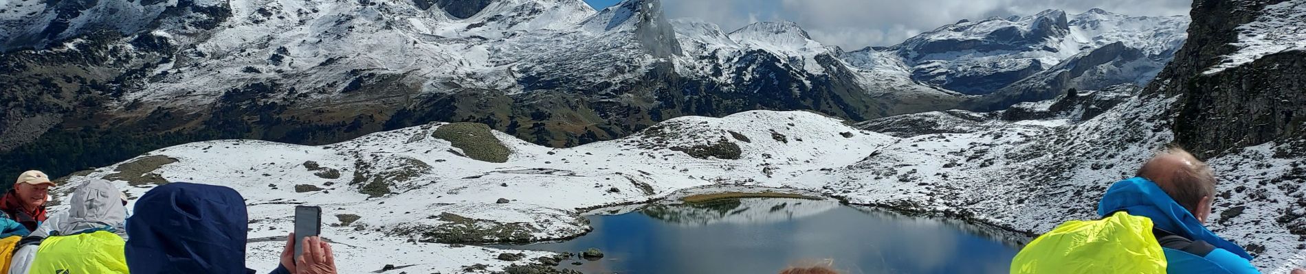
lacs d'Ayous

LouisROGER
User GUIDE
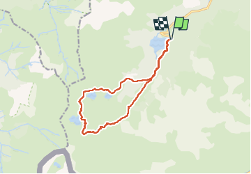

Length
14.5 km

Max alt
2101 m

Uphill gradient
740 m
Km-Effort
24 km

Min alt
1416 m

Downhill gradient
744 m
Boucle
Yes
Creation date :
2022-09-30 07:11:11.236
Updated on :
2022-09-30 14:45:40.906
7h33
Difficulty : Very difficult

FREE GPS app for hiking
 SityTrail
IGN / Geographical institutes
SityTrail Plus
The world is yours!
About
Trail Walking of 14.5 km to be discovered at New Aquitaine, Pyrénées-Atlantiques, Laruns. This trail is proposed by LouisROGER.
Photos


Positioning
Country:
France
Region :
New Aquitaine
Department/Province :
Pyrénées-Atlantiques
Municipality :
Laruns
Location:
Unknown
Start:(Dec)
Start:(UTM)
708454 ; 4749372 (30T) N.
Comments