Trail Walking Ustou - Alet lacarde - Photo

Alet lacarde

© OpenStreetMap contributors
Length
Length
13.3 km
Max alt
Max alt
2020 m
Uphill gradient
Uphill gradient
1239 m
Km-Effort
Km-Effort  
30 km
Min alt
Min alt
981 m
Downhill gradient
Downhill gradient
1243 m
Boucle
Boucle
Yes
Creation date :
2022-10-02 05:42:09.0
Updated on :
2022-10-04 07:12:12.567

(0 Reviews)

Walking
Walking
6h22
Difficulty : Very difficult

Scan this QR Code to open this trail in the SityTrail application

FREE GPS app for hiking

Logo SityTrail SityTrail

IGN / Geographical institutes

Download SityTrail from the App Store Download SityTrail from Google Play

Logo SityTrail SityTrail World

The world is yours!

Download SityTrail from the App Store Download SityTrail from Google Play Download SityTrail on Huawei AppGallery

About

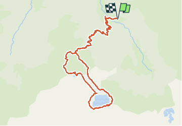
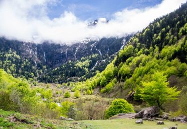
Trail Walking of 13.3 km to be discovered at Occitania, Ariège, Ustou. This trail is proposed by georghinio.

Description

Départ du parking de Cagateille direction l'étang d'Alet, attention le tour du lac n'est pas conseillé...puis aller vers l'étang de Lacarde puis redescendre par un sentier mal balisé jusqu'à rejoindre le chemin pris auparavant pour aller au parking.

Elevation profile

Photos

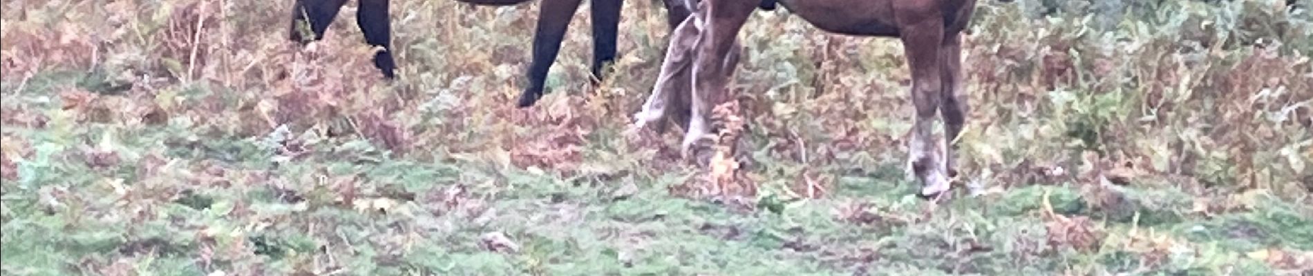
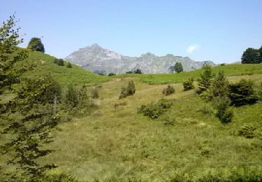
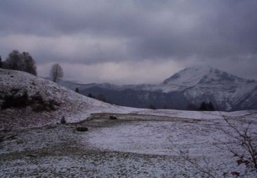
31 photos in total. Please click on a photo to see them all in the gallery.

Positioning

Country:
France
Region :
Occitania
Department/Province :
Ariège
Municipality :
Ustou
Location:
Unknown
Start:(UTM)
359853 ; 4735163 (31T) N.

Trails nearby

Trail Walking Ustou - Col de serre - Photo
Walking
georghinio

Walking

(1)
Ustou, Occitania, Ariège, France
6.3 km | 13.6 km-effort
1h 56min
Yes
Trail Walking Aulus-les-Bains - cascade ars et etang guzet - Photo
Walking
fbienmuller

Walking

Difficult
(1)
Aulus-les-Bains, Occitania, Ariège, France
15.3 km | 28 km-effort
4h 58min
Yes
Trail Walking Aulus-les-Bains - Le plateau de Souliou - Photo
Walking
tracegps

Walking

Difficult
(1)
Aulus-les-Bains, Occitania, Ariège, France
6.3 km | 13.4 km-effort
2h 45min
Yes
Trail Walking Ustou - Le tour de la cabane d'Ardio - Photo
Walking
tracegps

Walking

Medium
(1)
Ustou, Occitania, Ariège, France
4.4 km | 7.1 km-effort
1h 30min
Yes
Trail Walking Ustou - Les Cascades du chemin d'Espagne - Photo
Walking
tracegps

Walking

Medium
(1)
Ustou, Occitania, Ariège, France
8.1 km | 13.1 km-effort
2h 30min
Yes
Trail Walking Aulus-les-Bains - Cascade d'Ars - Étang de Guzet - Photo
Walking
toutankhcarton

Walking

Medium
(1)
Aulus-les-Bains, Occitania, Ariège, France
15 km | 27 km-effort
6h 12min
Yes
Trail Walking Aulus-les-Bains - Le tours des cascades - Photo
Walking
patricklecetre

Walking

Medium
(1)
Aulus-les-Bains, Occitania, Ariège, France
11.7 km | 23 km-effort
4h 51min
Yes
Trail Walking Aulus-les-Bains - D31 - GR 10 - Photo
Walking
loic09

Walking

Medium
(1)
Aulus-les-Bains, Occitania, Ariège, France
18.6 km | 35 km-effort
7h 46min
No
Trail On foot Ustou - Le cirque de Cagateille - Photo
On foot
PRO

On foot

Medium
Ustou, Occitania, Ariège, France
11.1 km | 26 km-effort
5h 49min
Yes


Close
My subscriptions