Trail Walking Seix - Pyrénées-140901 - ValléeEstours - Photo

Pyrénées-140901 - ValléeEstours

 randodan
randodan

User

© OpenStreetMap contributors
Length
Length
12.7 km
Max alt
Max alt
1134 m
Uphill gradient
Uphill gradient
518 m
Km-Effort
Km-Effort  
19.7 km
Min alt
Min alt
664 m
Downhill gradient
Downhill gradient
522 m
Boucle
Boucle
Yes
Creation date :
2014-12-10 00:00:00.0
Updated on :
2014-12-10 00:00:00.0

(0 Reviews)

Walking
Walking
6h00
Difficulty : Easy

Scan this QR Code to open this trail in the SityTrail application

FREE GPS app for hiking

Logo SityTrail SityTrail

IGN / Geographical institutes

Download SityTrail from the App Store Download SityTrail from Google Play

Logo SityTrail SityTrail World

The world is yours!

Download SityTrail from the App Store Download SityTrail from Google Play Download SityTrail on Huawei AppGallery

About

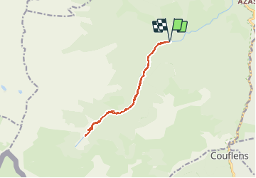
Trail Walking of 12.7 km to be discovered at Occitania, Ariège, Seix. This trail is proposed by randodan.

Description

2014 - Camp de base : Soueix - 01 sep -<br>
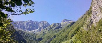
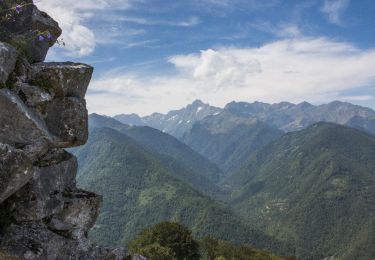
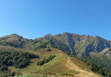
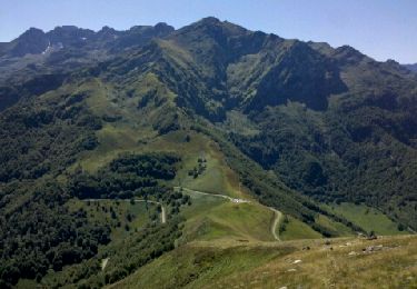
Vallée d'Estours par le GR10.<br>
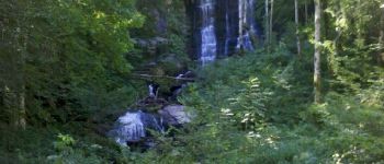
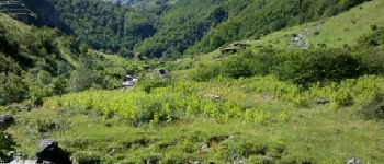
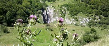
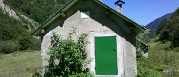
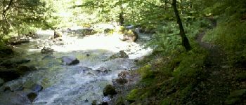
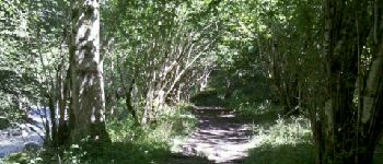
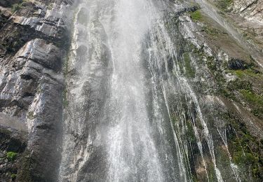
Départ 9h40 du parking de l'ancienne carrière de marbre (682 m) . La remontée du Ruisseau d'Estours - qui prend nom de Ruisseau d'Artigue en amont du Bidet - c'est une très longue approche de l'estive, beaucoup de yoyo . En sortie de forêt, impossible de traverser le ruisseau, trop gonflé, pour aller à la cascade . Avions raté la suite montante du GR10, demi-tour et on le retrouve.<br>
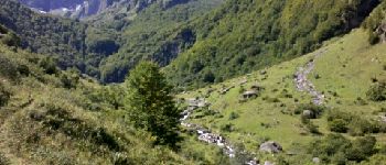
Pause casse-croûte vers 13h30 sur le GR (~ 1130 m).<br>
A la descente, très mal à la jambe.<br>
16h20, de retour à la voiture.<br>
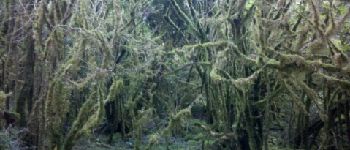
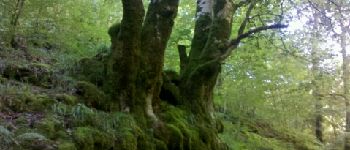
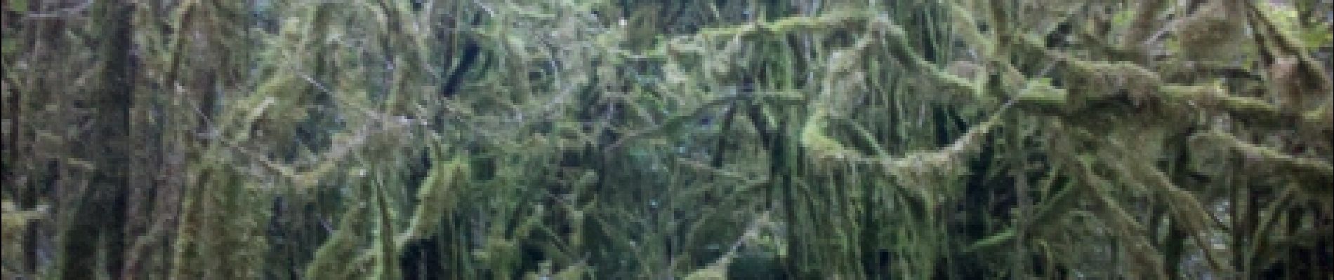
A noter : les arbres particulièrement moussus.<br>
<small>(Suite à un gros cafouillage du GPS, j'ai dû largement corriger la trace . De ce fait, la position des photos associées est très incertaine.)</small>

Elevation profile

Photos

Points of interest

Positioning

Country:
France
Region :
Occitania
Department/Province :
Ariège
Municipality :
Seix
Location:
Unknown
Start:(UTM)
349412 ; 4743325 (31T) N.

Trails nearby

Trail Walking Seix - Le Château de Mirabat par Azas - Photo
Walking
alain2306

Walking

Difficult
(1)
Seix, Occitania, Ariège, France
10.1 km | 18.8 km-effort
4h 15min
Yes
Trail Walking Seix - Le Pic de Fonta - Photo
Walking
tracegps

Walking

Difficult
(1)
Seix, Occitania, Ariège, France
9.2 km | 20 km-effort
5h 0min
Yes
Trail Walking Bethmale - Cap de Bouirex - Photo
Walking
counoise

Walking

Difficult
Bethmale, Occitania, Ariège, France
8.8 km | 16.1 km-effort
3h 18min
Yes
Trail Walking Seix - 2022 TRANSPYRÉNÉENNE : 6ème etape : Refuge d’Esbints - cabane Aula - Photo
Walking
LEGUE

Walking

Very difficult
Seix, Occitania, Ariège, France
23 km | 38 km-effort
6h 18min
No
Trail Walking Sentenac-d'Oust - 2020-08-25 col de la cor - col d'Auédole - étang d'Ayes - col d'Auédole - étang d'Eychelle - col de la core. - Photo
Walking
jacq58

Walking

Difficult
(1)
Sentenac-d'Oust, Occitania, Ariège, France
11.4 km | 21 km-effort
4h 16min
Yes
Trail Walking Seix - Cour Vic - Photo
Walking
petit-pied

Walking

Medium
(1)
Seix, Occitania, Ariège, France
11.2 km | 23 km-effort
5h 18min
Yes
Trail Walking Seix - Cabane d'Aula - Photo
Walking
chrisgps

Walking

Very difficult
Seix, Occitania, Ariège, France
18.1 km | 31 km-effort
7h 2min
Yes
Trail Walking Bethmale - Pyrénées-140903 - CapBouirex - Photo
Walking
randodan

Walking

Difficult
Bethmale, Occitania, Ariège, France
4.8 km | 10.9 km-effort
5h 15min
Yes
Trail Mountain bike Bethmale - Col de la Core - Port d'Aulat-Montgarri - Port d'Urets - Photo
Mountain bike
tracegps

Mountain bike

Very difficult
Bethmale, Occitania, Ariège, France
98 km | 152 km-effort
16h 0min
No


Close
My subscriptions